KURK Kurchatov, Kazakhstan - Earthquake Result Viewer
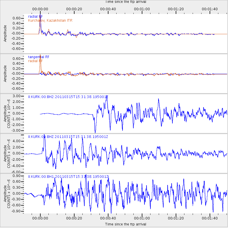
Earthquake location: Off East Coast Of Honshu, Japan
Earthquake latitude/longitude: 40.3/143.3
Earthquake time(UTC): 2011/03/15 (074) 15:23:53 GMT
Earthquake Depth: 18 km
Earthquake Magnitude: 6.1 MW, 5.6 MB, 5.9 MS, 6.1 MW
Earthquake Catalog/Contributor: NEIC PDE/NEIC PDE-M
Network: II Global Seismograph Network (GSN - IRIS/IDA)
Station: KURK Kurchatov, Kazakhstan
Lat/Lon: 50.72 N/78.62 E
Elevation: 184 m
Distance: 45.1 deg
Az: 305.819 deg
Baz: 77.166 deg
Ray Param: 0.07146502
Estimated Moho Depth: 44.25 km
Estimated Crust Vp/Vs: 1.62
Assumed Crust Vp: 6.552 km/s
Estimated Crust Vs: 4.032 km/s
Estimated Crust Poisson's Ratio: 0.20
Radial Match: 97.5702 %
Radial Bump: 356
Transverse Match: 83.89418 %
Transverse Bump: 400
SOD ConfigId: 558545
Insert Time: 2013-09-18 14:00:31.501 +0000
GWidth: 2.5
Max Bumps: 400
Tol: 0.001

Signal To Noise

ChannelStoNSTALTA
II:KURK:00:BHZ:20110315T15:31:38.195001Z28.0770072.404896E-68.5653575E-8
II:KURK:00:BH1:20110315T15:31:38.195001Z3.3900452.2608755E-76.6691605E-8
II:KURK:00:BH2:20110315T15:31:38.195001Z18.1174321.2771627E-67.049359E-8
Arrivals
Ps4.5 SECOND
PpPs16 SECOND
PsPs/PpSs21 SECOND