You are here: Home > Network List > II - Global Seismograph Network (GSN - IRIS/IDA) Stations List
> Station PFO Pinon Flat, California, USA > Earthquake Result Viewer
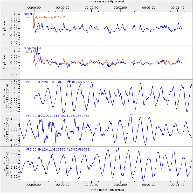
PFO Pinon Flat, California, USA - Earthquake Result Viewer
*The percent match for this event was below the threshold and hence no stack was calculated.
| Earthquake location: |
Near East Coast Of Honshu, Japan |
| Earthquake latitude/longitude: |
35.2/141.0 |
| Earthquake time(UTC): |
2011/03/15 (074) 20:29:59 GMT |
| Earthquake Depth: |
19 km |
| Earthquake Magnitude: |
5.7 MW, 5.6 MW, 5.6 MB |
| Earthquake Catalog/Contributor: |
NEIC PDE/NEIC PDE-M |
|
| Network: |
II Global Seismograph Network (GSN - IRIS/IDA) |
| Station: |
PFO Pinon Flat, California, USA |
| Lat/Lon: |
33.61 N/116.46 W |
| Elevation: |
1280 m |
|
| Distance: |
80.3 deg |
| Az: |
55.72 deg |
| Baz: |
305.826 deg |
| Ray Param: |
$rayparam |
*The percent match for this event was below the threshold and hence was not used in the summary stack. |
|
| Radial Match: |
42.357693 % |
| Radial Bump: |
400 |
| Transverse Match: |
80.575874 % |
| Transverse Bump: |
400 |
| SOD ConfigId: |
558545 |
| Insert Time: |
2013-09-18 14:01:50.545 +0000 |
| GWidth: |
2.5 |
| Max Bumps: |
400 |
| Tol: |
0.001 |
|
Signal To Noise
| Channel | StoN | STA | LTA |
| II:PFO:00:BHZ:20110315T20:41:38.268975Z | 1.624237 | 6.1371145E-7 | 3.7784602E-7 |
| II:PFO:00:BH1:20110315T20:41:38.268975Z | 1.0665169 | 3.5870855E-7 | 3.3633648E-7 |
| II:PFO:00:BH2:20110315T20:41:38.268975Z | 0.7966143 | 3.5001008E-7 | 4.393721E-7 |
| Arrivals |
| Ps | |
| PpPs | |
| PsPs/PpSs | |


