You are here: Home > Network List > II - Global Seismograph Network (GSN - IRIS/IDA) Stations List
> Station WRAB Tennant Creek, NT, Australia > Earthquake Result Viewer
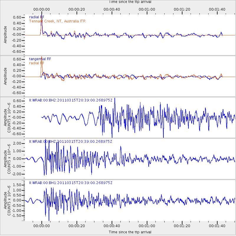
WRAB Tennant Creek, NT, Australia - Earthquake Result Viewer
*The percent match for this event was below the threshold and hence no stack was calculated.
| Earthquake location: |
Near East Coast Of Honshu, Japan |
| Earthquake latitude/longitude: |
35.2/141.0 |
| Earthquake time(UTC): |
2011/03/15 (074) 20:29:59 GMT |
| Earthquake Depth: |
19 km |
| Earthquake Magnitude: |
5.7 MW, 5.6 MW, 5.6 MB |
| Earthquake Catalog/Contributor: |
NEIC PDE/NEIC PDE-M |
|
| Network: |
II Global Seismograph Network (GSN - IRIS/IDA) |
| Station: |
WRAB Tennant Creek, NT, Australia |
| Lat/Lon: |
19.93 S/134.36 E |
| Elevation: |
366 m |
|
| Distance: |
55.2 deg |
| Az: |
187.606 deg |
| Baz: |
6.616 deg |
| Ray Param: |
$rayparam |
*The percent match for this event was below the threshold and hence was not used in the summary stack. |
|
| Radial Match: |
76.76964 % |
| Radial Bump: |
400 |
| Transverse Match: |
64.39138 % |
| Transverse Bump: |
400 |
| SOD ConfigId: |
558545 |
| Insert Time: |
2013-09-18 14:01:59.369 +0000 |
| GWidth: |
2.5 |
| Max Bumps: |
400 |
| Tol: |
0.001 |
|
Signal To Noise
| Channel | StoN | STA | LTA |
| II:WRAB:00:BHZ:20110315T20:39:00.268975Z | 6.755847 | 1.0555985E-6 | 1.5624963E-7 |
| II:WRAB:00:BH1:20110315T20:39:00.268975Z | 7.08553 | 6.2431985E-7 | 8.8111946E-8 |
| II:WRAB:00:BH2:20110315T20:39:00.268975Z | 2.7227793 | 2.4777734E-7 | 9.100163E-8 |
| Arrivals |
| Ps | |
| PpPs | |
| PsPs/PpSs | |


