You are here: Home > Network List > IU - Global Seismograph Network (GSN - IRIS/USGS) Stations List
> Station MAKZ Makanchi, Kazakhstan > Earthquake Result Viewer
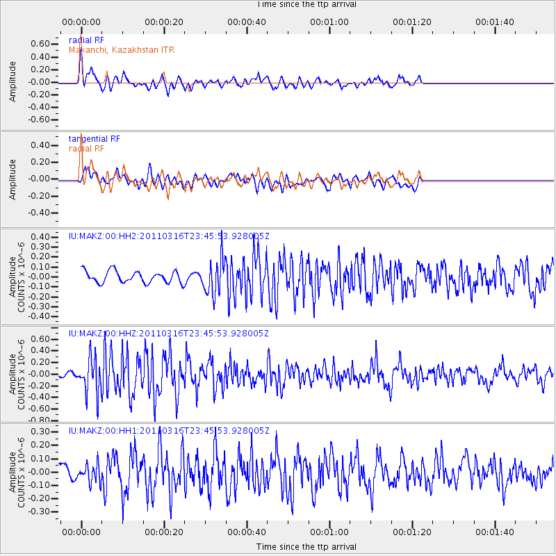
MAKZ Makanchi, Kazakhstan - Earthquake Result Viewer
*The percent match for this event was below the threshold and hence no stack was calculated.
| Earthquake location: |
Near East Coast Of Honshu, Japan |
| Earthquake latitude/longitude: |
39.1/142.5 |
| Earthquake time(UTC): |
2011/03/16 (075) 23:38:20 GMT |
| Earthquake Depth: |
35 km |
| Earthquake Magnitude: |
5.7 MB |
| Earthquake Catalog/Contributor: |
NEIC PDE/NEIC PDE-M |
|
| Network: |
IU Global Seismograph Network (GSN - IRIS/USGS) |
| Station: |
MAKZ Makanchi, Kazakhstan |
| Lat/Lon: |
46.81 N/81.98 E |
| Elevation: |
600 m |
|
| Distance: |
44.0 deg |
| Az: |
300.549 deg |
| Baz: |
77.201 deg |
| Ray Param: |
$rayparam |
*The percent match for this event was below the threshold and hence was not used in the summary stack. |
|
| Radial Match: |
67.23953 % |
| Radial Bump: |
349 |
| Transverse Match: |
45.08691 % |
| Transverse Bump: |
400 |
| SOD ConfigId: |
558545 |
| Insert Time: |
2013-09-18 14:07:38.709 +0000 |
| GWidth: |
2.5 |
| Max Bumps: |
400 |
| Tol: |
0.001 |
|
Signal To Noise
| Channel | StoN | STA | LTA |
| IU:MAKZ:00:HHZ:20110316T23:45:53.928005Z | 4.788104 | 2.9789783E-7 | 6.221624E-8 |
| IU:MAKZ:00:HH1:20110316T23:45:53.928005Z | 1.197986 | 6.5589575E-8 | 5.474987E-8 |
| IU:MAKZ:00:HH2:20110316T23:45:53.928005Z | 3.0612276 | 1.7785615E-7 | 5.809962E-8 |
| Arrivals |
| Ps | |
| PpPs | |
| PsPs/PpSs | |


