You are here: Home > Network List > IU - Global Seismograph Network (GSN - IRIS/USGS) Stations List
> Station MAKZ Makanchi, Kazakhstan > Earthquake Result Viewer
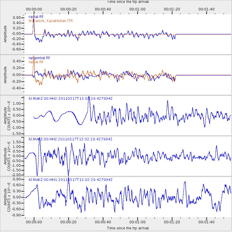
MAKZ Makanchi, Kazakhstan - Earthquake Result Viewer
*The percent match for this event was below the threshold and hence no stack was calculated.
| Earthquake location: |
Near East Coast Of Honshu, Japan |
| Earthquake latitude/longitude: |
36.8/141.2 |
| Earthquake time(UTC): |
2011/03/17 (076) 12:54:52 GMT |
| Earthquake Depth: |
29 km |
| Earthquake Magnitude: |
5.8 MW, 5.9 MW, 6.1 MB |
| Earthquake Catalog/Contributor: |
NEIC PDE/NEIC PDE-M |
|
| Network: |
IU Global Seismograph Network (GSN - IRIS/USGS) |
| Station: |
MAKZ Makanchi, Kazakhstan |
| Lat/Lon: |
46.81 N/81.98 E |
| Elevation: |
600 m |
|
| Distance: |
44.3 deg |
| Az: |
302.381 deg |
| Baz: |
80.891 deg |
| Ray Param: |
$rayparam |
*The percent match for this event was below the threshold and hence was not used in the summary stack. |
|
| Radial Match: |
69.741356 % |
| Radial Bump: |
400 |
| Transverse Match: |
64.46677 % |
| Transverse Bump: |
400 |
| SOD ConfigId: |
558545 |
| Insert Time: |
2013-09-18 14:13:40.143 +0000 |
| GWidth: |
2.5 |
| Max Bumps: |
400 |
| Tol: |
0.001 |
|
Signal To Noise
| Channel | StoN | STA | LTA |
| IU:MAKZ:00:HHZ:20110317T13:02:29.427994Z | 5.7007732 | 1.0991986E-6 | 1.928157E-7 |
| IU:MAKZ:00:HH1:20110317T13:02:29.427994Z | 2.3699846 | 4.3043812E-7 | 1.8162065E-7 |
| IU:MAKZ:00:HH2:20110317T13:02:29.427994Z | 2.7493582 | 6.932998E-7 | 2.521679E-7 |
| Arrivals |
| Ps | |
| PpPs | |
| PsPs/PpSs | |


