You are here: Home > Network List > II - Global Seismograph Network (GSN - IRIS/IDA) Stations List
> Station WRAB Tennant Creek, NT, Australia > Earthquake Result Viewer
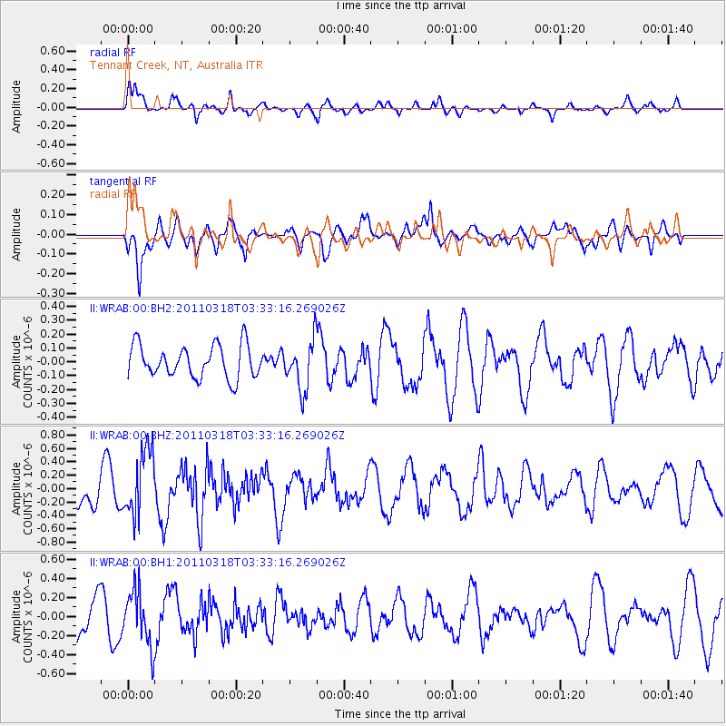
WRAB Tennant Creek, NT, Australia - Earthquake Result Viewer
*The percent match for this event was below the threshold and hence no stack was calculated.
| Earthquake location: |
Off East Coast Of Honshu, Japan |
| Earthquake latitude/longitude: |
37.8/143.5 |
| Earthquake time(UTC): |
2011/03/18 (077) 03:23:53 GMT |
| Earthquake Depth: |
6.4 km |
| Earthquake Magnitude: |
5.5 MW, 5.6 MB |
| Earthquake Catalog/Contributor: |
NEIC PDE/NEIC PDE-M |
|
| Network: |
II Global Seismograph Network (GSN - IRIS/IDA) |
| Station: |
WRAB Tennant Creek, NT, Australia |
| Lat/Lon: |
19.93 S/134.36 E |
| Elevation: |
366 m |
|
| Distance: |
58.0 deg |
| Az: |
190.134 deg |
| Baz: |
8.524 deg |
| Ray Param: |
$rayparam |
*The percent match for this event was below the threshold and hence was not used in the summary stack. |
|
| Radial Match: |
75.81208 % |
| Radial Bump: |
400 |
| Transverse Match: |
49.647705 % |
| Transverse Bump: |
400 |
| SOD ConfigId: |
558545 |
| Insert Time: |
2013-09-18 14:15:50.658 +0000 |
| GWidth: |
2.5 |
| Max Bumps: |
400 |
| Tol: |
0.001 |
|
Signal To Noise
| Channel | StoN | STA | LTA |
| II:WRAB:00:BHZ:20110318T03:33:16.269026Z | 2.3988035 | 4.946335E-7 | 2.0620011E-7 |
| II:WRAB:00:BH1:20110318T03:33:16.269026Z | 1.8671912 | 2.9314577E-7 | 1.5699827E-7 |
| II:WRAB:00:BH2:20110318T03:33:16.269026Z | 1.546257 | 1.8160411E-7 | 1.17447556E-7 |
| Arrivals |
| Ps | |
| PpPs | |
| PsPs/PpSs | |


