KURK Kurchatov, Kazakhstan - Earthquake Result Viewer
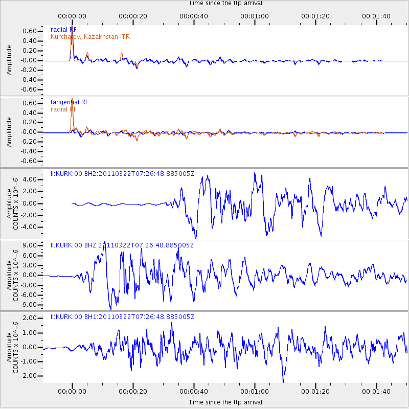
Earthquake location: Off East Coast Of Honshu, Japan
Earthquake latitude/longitude: 37.2/144.0
Earthquake time(UTC): 2011/03/22 (081) 07:18:45 GMT
Earthquake Depth: 11 km
Earthquake Magnitude: 6.5 MW, 6.2 MS, 6.3 MB, 6.4 MW
Earthquake Catalog/Contributor: NEIC PDE/NEIC PDE-M
Network: II Global Seismograph Network (GSN - IRIS/IDA)
Station: KURK Kurchatov, Kazakhstan
Lat/Lon: 50.72 N/78.62 E
Elevation: 184 m
Distance: 47.4 deg
Az: 308.3 deg
Baz: 80.109 deg
Ray Param: 0.06999343
Estimated Moho Depth: 43.5 km
Estimated Crust Vp/Vs: 1.68
Assumed Crust Vp: 6.552 km/s
Estimated Crust Vs: 3.912 km/s
Estimated Crust Poisson's Ratio: 0.22
Radial Match: 97.92416 %
Radial Bump: 287
Transverse Match: 89.685074 %
Transverse Bump: 400
SOD ConfigId: 558545
Insert Time: 2013-09-18 14:31:45.307 +0000
GWidth: 2.5
Max Bumps: 400
Tol: 0.001

Signal To Noise

ChannelStoNSTALTA
II:KURK:00:BHZ:20110322T07:26:48.885005Z5.82204876.655783E-71.1432029E-7
II:KURK:00:BH1:20110322T07:26:48.885005Z1.62175291.2310998E-77.591168E-8
II:KURK:00:BH2:20110322T07:26:48.885005Z2.4103443.1192087E-71.2940927E-7
Arrivals
Ps4.8 SECOND
PpPs17 SECOND
PsPs/PpSs21 SECOND