You are here: Home > Network List > IU - Global Seismograph Network (GSN - IRIS/USGS) Stations List
> Station HNR Honiara, Solomon Islands > Earthquake Result Viewer
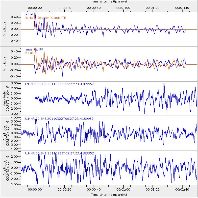
HNR Honiara, Solomon Islands - Earthquake Result Viewer
*The percent match for this event was below the threshold and hence no stack was calculated.
| Earthquake location: |
Near East Coast Of Honshu, Japan |
| Earthquake latitude/longitude: |
37.3/141.8 |
| Earthquake time(UTC): |
2011/03/22 (081) 09:19:06 GMT |
| Earthquake Depth: |
31 km |
| Earthquake Magnitude: |
6.1 MW, 5.9 MB, 5.9 MS, 6.0 MW |
| Earthquake Catalog/Contributor: |
NEIC PDE/NEIC PDE-M |
|
| Network: |
IU Global Seismograph Network (GSN - IRIS/USGS) |
| Station: |
HNR Honiara, Solomon Islands |
| Lat/Lon: |
9.44 S/159.95 E |
| Elevation: |
100 m |
|
| Distance: |
49.5 deg |
| Az: |
156.164 deg |
| Baz: |
340.943 deg |
| Ray Param: |
$rayparam |
*The percent match for this event was below the threshold and hence was not used in the summary stack. |
|
| Radial Match: |
70.3564 % |
| Radial Bump: |
400 |
| Transverse Match: |
70.85082 % |
| Transverse Bump: |
400 |
| SOD ConfigId: |
558545 |
| Insert Time: |
2013-09-18 14:33:52.055 +0000 |
| GWidth: |
2.5 |
| Max Bumps: |
400 |
| Tol: |
0.001 |
|
Signal To Noise
| Channel | StoN | STA | LTA |
| IU:HNR:00:BHZ:20110322T09:27:23.418995Z | 3.6207833 | 1.9542304E-6 | 5.397258E-7 |
| IU:HNR:00:BH1:20110322T09:27:23.418995Z | 4.3627806 | 1.4653443E-6 | 3.3587395E-7 |
| IU:HNR:00:BH2:20110322T09:27:23.418995Z | 1.643246 | 6.4752845E-7 | 3.9405447E-7 |
| Arrivals |
| Ps | |
| PpPs | |
| PsPs/PpSs | |


