
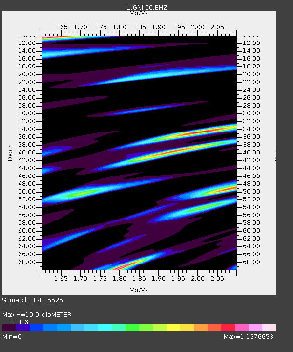
GNI Garni, Armenia - Earthquake Result Viewer
| ||||||||||||||||||
| ||||||||||||||||||
| ||||||||||||||||||
|
Signal To Noise
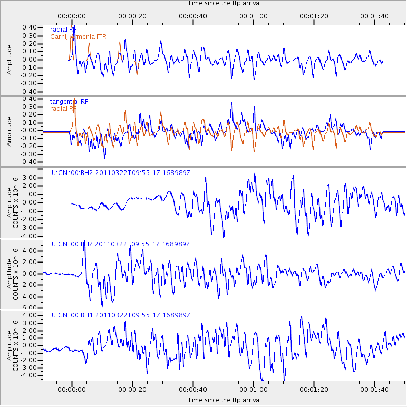
| Channel | StoN | STA | LTA |
| IU:GNI:00:BHZ:20110322T09:55:17.168989Z | 7.519414 | 1.8968252E-6 | 2.5225705E-7 |
| IU:GNI:00:BH1:20110322T09:55:17.168989Z | 2.0429914 | 9.874362E-7 | 4.833287E-7 |
| IU:GNI:00:BH2:20110322T09:55:17.168989Z | 2.0995958 | 1.0088661E-6 | 4.805049E-7 |
| Arrivals | |
| Ps | 1.0 SECOND |
| PpPs | 4.0 SECOND |
| PsPs/PpSs | 5.0 SECOND |

