You are here: Home > Network List > TA - USArray Transportable Network (new EarthScope stations) Stations List
> Station Z41A Richland Creek Farm, El Dorado, AR, USA > Earthquake Result Viewer
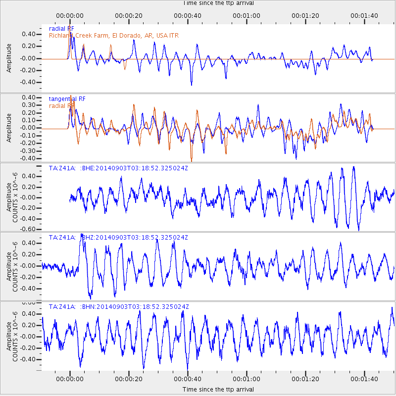
Z41A Richland Creek Farm, El Dorado, AR, USA - Earthquake Result Viewer
*The percent match for this event was below the threshold and hence no stack was calculated.
| Earthquake location: |
Iceland |
| Earthquake latitude/longitude: |
64.8/-17.4 |
| Earthquake time(UTC): |
2014/09/03 (246) 03:09:56 GMT |
| Earthquake Depth: |
7.5 km |
| Earthquake Magnitude: |
5.4 MW |
| Earthquake Catalog/Contributor: |
ISC/ISC |
|
| Network: |
TA USArray Transportable Network (new EarthScope stations) |
| Station: |
Z41A Richland Creek Farm, El Dorado, AR, USA |
| Lat/Lon: |
33.26 N/92.80 W |
| Elevation: |
62 m |
|
| Distance: |
54.3 deg |
| Az: |
272.995 deg |
| Baz: |
30.681 deg |
| Ray Param: |
$rayparam |
*The percent match for this event was below the threshold and hence was not used in the summary stack. |
|
| Radial Match: |
58.05111 % |
| Radial Bump: |
400 |
| Transverse Match: |
46.85577 % |
| Transverse Bump: |
400 |
| SOD ConfigId: |
3390531 |
| Insert Time: |
2019-04-13 19:16:13.094 +0000 |
| GWidth: |
2.5 |
| Max Bumps: |
400 |
| Tol: |
0.001 |
|
Signal To Noise
| Channel | StoN | STA | LTA |
| TA:Z41A: :BHZ:20140903T03:18:52.325024Z | 3.8049855 | 2.6301507E-7 | 6.912381E-8 |
| TA:Z41A: :BHN:20140903T03:18:52.325024Z | 1.0922687 | 2.4437418E-7 | 2.2373084E-7 |
| TA:Z41A: :BHE:20140903T03:18:52.325024Z | 0.9082112 | 1.3058192E-7 | 1.4377926E-7 |
| Arrivals |
| Ps | |
| PpPs | |
| PsPs/PpSs | |


