You are here: Home > Network List > CN - Canadian National Seismograph Network Stations List
> Station FRB IQALUIT, N.W.T. > Earthquake Result Viewer
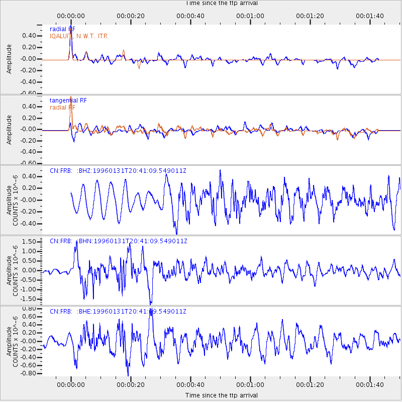
FRB IQALUIT, N.W.T. - Earthquake Result Viewer
*The percent match for this event was below the threshold and hence no stack was calculated.
| Earthquake location: |
Kuril Islands |
| Earthquake latitude/longitude: |
44.5/149.4 |
| Earthquake time(UTC): |
1996/01/31 (031) 20:30:47 GMT |
| Earthquake Depth: |
58 km |
| Earthquake Magnitude: |
5.8 MB, 6.1 UNKNOWN, 5.9 MW |
| Earthquake Catalog/Contributor: |
WHDF/NEIC |
|
| Network: |
CN Canadian National Seismograph Network |
| Station: |
FRB IQALUIT, N.W.T. |
| Lat/Lon: |
63.75 N/68.55 W |
| Elevation: |
18 m |
|
| Distance: |
68.0 deg |
| Az: |
17.138 deg |
| Baz: |
331.672 deg |
| Ray Param: |
$rayparam |
*The percent match for this event was below the threshold and hence was not used in the summary stack. |
|
| Radial Match: |
76.964676 % |
| Radial Bump: |
400 |
| Transverse Match: |
58.816822 % |
| Transverse Bump: |
400 |
| SOD ConfigId: |
4480 |
| Insert Time: |
2010-02-27 05:55:16.011 +0000 |
| GWidth: |
2.5 |
| Max Bumps: |
400 |
| Tol: |
0.001 |
|
Signal To Noise
| Channel | StoN | STA | LTA |
| CN:FRB: :BHN:19960131T20:41:09.549011Z | 4.819468 | 7.33141E-7 | 1.5212073E-7 |
| CN:FRB: :BHE:19960131T20:41:09.549011Z | 2.232873 | 2.8588005E-7 | 1.2803238E-7 |
| CN:FRB: :BHZ:19960131T20:41:09.549011Z | 1.2732645 | 2.5002274E-7 | 1.9636354E-7 |
| Arrivals |
| Ps | |
| PpPs | |
| PsPs/PpSs | |


