You are here: Home > Network List > CN - Canadian National Seismograph Network Stations List
> Station FRB IQALUIT, N.W.T. > Earthquake Result Viewer
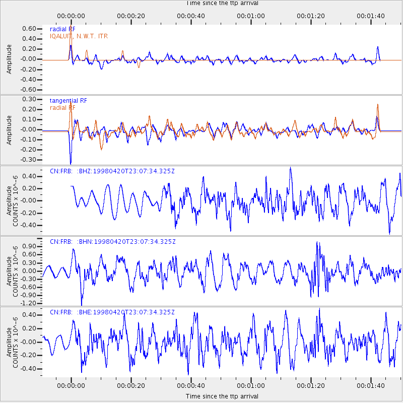
FRB IQALUIT, N.W.T. - Earthquake Result Viewer
*The percent match for this event was below the threshold and hence no stack was calculated.
| Earthquake location: |
Guerrero, Mexico |
| Earthquake latitude/longitude: |
18.5/-101.2 |
| Earthquake time(UTC): |
1998/04/20 (110) 22:59:14 GMT |
| Earthquake Depth: |
67 km |
| Earthquake Magnitude: |
5.9 MB, 6.0 UNKNOWN, 5.9 MW |
| Earthquake Catalog/Contributor: |
WHDF/NEIC |
|
| Network: |
CN Canadian National Seismograph Network |
| Station: |
FRB IQALUIT, N.W.T. |
| Lat/Lon: |
63.75 N/68.55 W |
| Elevation: |
18 m |
|
| Distance: |
50.3 deg |
| Az: |
18.161 deg |
| Baz: |
221.68 deg |
| Ray Param: |
$rayparam |
*The percent match for this event was below the threshold and hence was not used in the summary stack. |
|
| Radial Match: |
56.128223 % |
| Radial Bump: |
400 |
| Transverse Match: |
58.414944 % |
| Transverse Bump: |
400 |
| SOD ConfigId: |
4480 |
| Insert Time: |
2010-02-27 05:55:16.641 +0000 |
| GWidth: |
2.5 |
| Max Bumps: |
400 |
| Tol: |
0.001 |
|
Signal To Noise
| Channel | StoN | STA | LTA |
| CN:FRB: :BHN:19980420T23:07:34.325Z | 4.9160714 | 5.223515E-7 | 1.0625384E-7 |
| CN:FRB: :BHE:19980420T23:07:34.325Z | 1.2287788 | 2.106459E-7 | 1.7142702E-7 |
| CN:FRB: :BHZ:19980420T23:07:34.325Z | 1.1449261 | 1.719458E-7 | 1.5018071E-7 |
| Arrivals |
| Ps | |
| PpPs | |
| PsPs/PpSs | |


