You are here: Home > Network List > IU - Global Seismograph Network (GSN - IRIS/USGS) Stations List
> Station RSSD Black Hills, South Dakota, USA > Earthquake Result Viewer
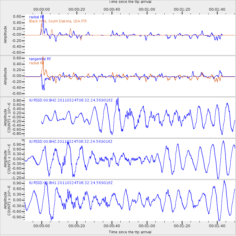
RSSD Black Hills, South Dakota, USA - Earthquake Result Viewer
*The percent match for this event was below the threshold and hence no stack was calculated.
| Earthquake location: |
Near East Coast Of Honshu, Japan |
| Earthquake latitude/longitude: |
39.1/142.1 |
| Earthquake time(UTC): |
2011/03/24 (083) 08:21:00 GMT |
| Earthquake Depth: |
27 km |
| Earthquake Magnitude: |
5.8 MW, 5.5 MB, 5.7 MS, 5.8 MW |
| Earthquake Catalog/Contributor: |
NEIC PDE/NEIC PDE-M |
|
| Network: |
IU Global Seismograph Network (GSN - IRIS/USGS) |
| Station: |
RSSD Black Hills, South Dakota, USA |
| Lat/Lon: |
44.12 N/104.04 W |
| Elevation: |
2090 m |
|
| Distance: |
78.0 deg |
| Az: |
42.328 deg |
| Baz: |
313.304 deg |
| Ray Param: |
$rayparam |
*The percent match for this event was below the threshold and hence was not used in the summary stack. |
|
| Radial Match: |
79.29494 % |
| Radial Bump: |
329 |
| Transverse Match: |
79.54159 % |
| Transverse Bump: |
400 |
| SOD ConfigId: |
558545 |
| Insert Time: |
2013-09-18 14:52:25.869 +0000 |
| GWidth: |
2.5 |
| Max Bumps: |
400 |
| Tol: |
0.001 |
|
Signal To Noise
| Channel | StoN | STA | LTA |
| IU:RSSD:00:BHZ:20110324T08:32:24.569016Z | 1.6988151 | 5.8111885E-7 | 3.4207306E-7 |
| IU:RSSD:00:BH1:20110324T08:32:24.569016Z | 3.0317225 | 6.1292724E-7 | 2.021713E-7 |
| IU:RSSD:00:BH2:20110324T08:32:24.569016Z | 2.715746 | 4.4249518E-7 | 1.6293689E-7 |
| Arrivals |
| Ps | |
| PpPs | |
| PsPs/PpSs | |


