You are here: Home > Network List > CN - Canadian National Seismograph Network Stations List
> Station FRB IQALUIT, N.W.T. > Earthquake Result Viewer
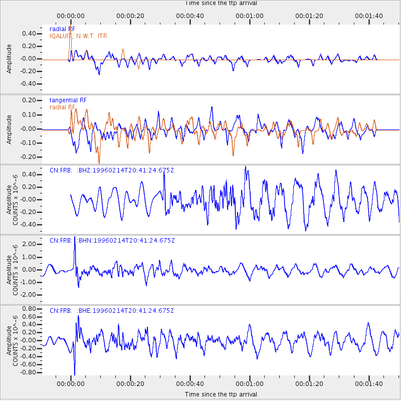
FRB IQALUIT, N.W.T. - Earthquake Result Viewer
*The percent match for this event was below the threshold and hence no stack was calculated.
| Earthquake location: |
Kuril Islands |
| Earthquake latitude/longitude: |
45.4/150.4 |
| Earthquake time(UTC): |
1996/02/14 (045) 20:31:06 GMT |
| Earthquake Depth: |
33 km |
| Earthquake Magnitude: |
5.9 MB, 5.2 MS, 5.8 UNKNOWN, 5.8 MW |
| Earthquake Catalog/Contributor: |
WHDF/NEIC |
|
| Network: |
CN Canadian National Seismograph Network |
| Station: |
FRB IQALUIT, N.W.T. |
| Lat/Lon: |
63.75 N/68.55 W |
| Elevation: |
18 m |
|
| Distance: |
66.9 deg |
| Az: |
17.671 deg |
| Baz: |
331.249 deg |
| Ray Param: |
$rayparam |
*The percent match for this event was below the threshold and hence was not used in the summary stack. |
|
| Radial Match: |
55.162464 % |
| Radial Bump: |
400 |
| Transverse Match: |
58.19577 % |
| Transverse Bump: |
400 |
| SOD ConfigId: |
4480 |
| Insert Time: |
2010-02-27 05:55:21.931 +0000 |
| GWidth: |
2.5 |
| Max Bumps: |
400 |
| Tol: |
0.001 |
|
Signal To Noise
| Channel | StoN | STA | LTA |
| CN:FRB: :BHN:19960214T20:41:24.675Z | 2.6571374 | 7.541804E-7 | 2.8383195E-7 |
| CN:FRB: :BHE:19960214T20:41:24.675Z | 2.1980731 | 3.0577084E-7 | 1.391086E-7 |
| CN:FRB: :BHZ:19960214T20:41:24.675Z | 1.1376852 | 1.5954478E-7 | 1.4023632E-7 |
| Arrivals |
| Ps | |
| PpPs | |
| PsPs/PpSs | |


