
PALK Pallekele, Sri Lanka - Earthquake Result Viewer
| ||||||||||||||||||
| ||||||||||||||||||
| ||||||||||||||||||
|
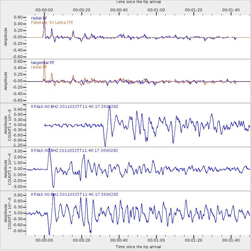
Signal To Noise
| Channel | StoN | STA | LTA |
| II:PALK:00:BHZ:20110325T11:46:17.369028Z | 19.503881 | 1.6761861E-6 | 8.594115E-8 |
| II:PALK:00:BH1:20110325T11:46:17.369028Z | 11.7758045 | 5.0939514E-7 | 4.3257778E-8 |
| II:PALK:00:BH2:20110325T11:46:17.369028Z | 12.197361 | 6.053049E-7 | 4.962589E-8 |
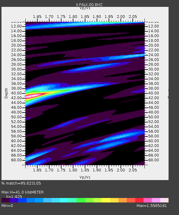
| Arrivals | |
| Ps | 4.1 SECOND |
| PpPs | 16 SECOND |
| PsPs/PpSs | 20 SECOND |

