
KURK Kurchatov, Kazakhstan - Earthquake Result Viewer
| ||||||||||||||||||
| ||||||||||||||||||
| ||||||||||||||||||
|
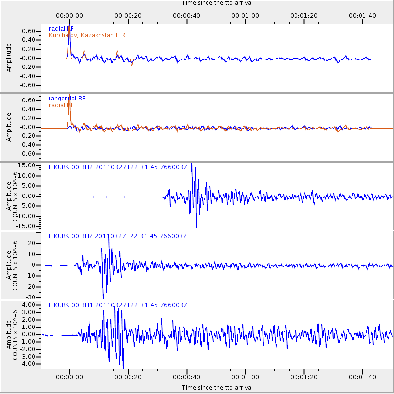
Signal To Noise
| Channel | StoN | STA | LTA |
| II:KURK:00:BHZ:20110327T22:31:45.766003Z | 24.674015 | 2.8019122E-6 | 1.135572E-7 |
| II:KURK:00:BH1:20110327T22:31:45.766003Z | 6.882226 | 2.419869E-7 | 3.5161136E-8 |
| II:KURK:00:BH2:20110327T22:31:45.766003Z | 24.196173 | 1.3815285E-6 | 5.7096983E-8 |
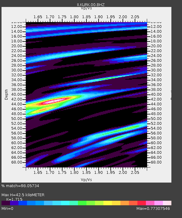
| Arrivals | |
| Ps | 5.0 SECOND |
| PpPs | 16 SECOND |
| PsPs/PpSs | 21 SECOND |

