You are here: Home > Network List > IU - Global Seismograph Network (GSN - IRIS/USGS) Stations List
> Station HNR Honiara, Solomon Islands > Earthquake Result Viewer
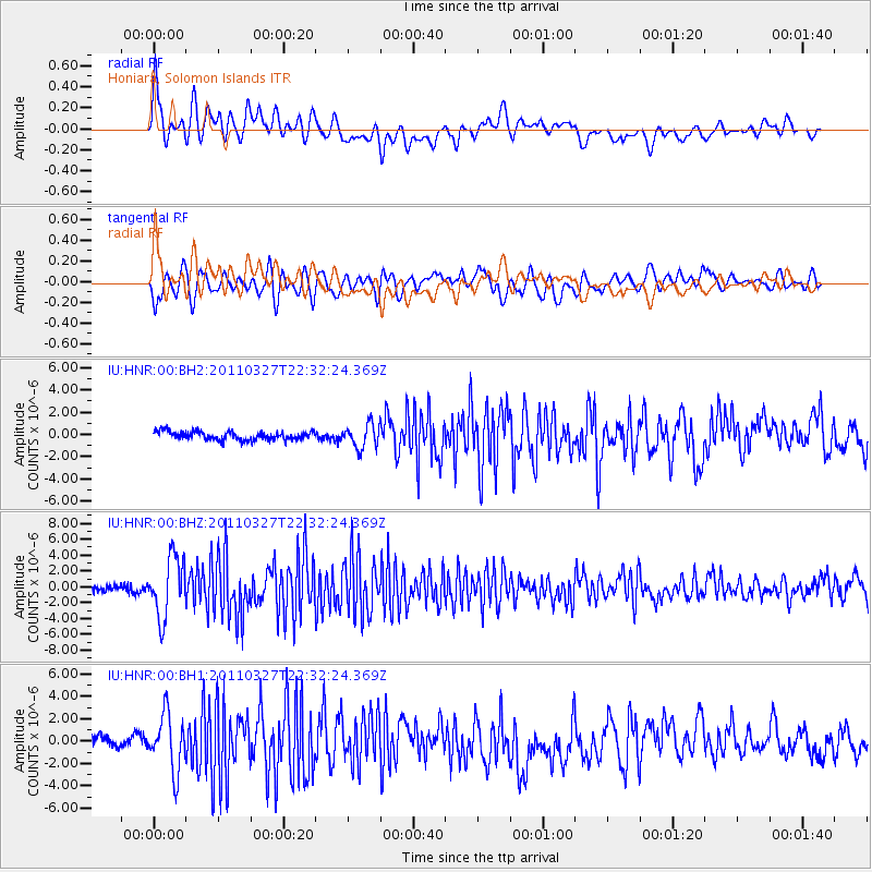
HNR Honiara, Solomon Islands - Earthquake Result Viewer
*The percent match for this event was below the threshold and hence no stack was calculated.
| Earthquake location: |
Near East Coast Of Honshu, Japan |
| Earthquake latitude/longitude: |
38.4/142.0 |
| Earthquake time(UTC): |
2011/03/27 (086) 22:23:58 GMT |
| Earthquake Depth: |
19 km |
| Earthquake Magnitude: |
6.1 MW, 6.1 MS, 6.2 MW, 6.3 MB |
| Earthquake Catalog/Contributor: |
NEIC PDE/NEIC PDE-M |
|
| Network: |
IU Global Seismograph Network (GSN - IRIS/USGS) |
| Station: |
HNR Honiara, Solomon Islands |
| Lat/Lon: |
9.44 S/159.95 E |
| Elevation: |
100 m |
|
| Distance: |
50.5 deg |
| Az: |
156.797 deg |
| Baz: |
341.718 deg |
| Ray Param: |
$rayparam |
*The percent match for this event was below the threshold and hence was not used in the summary stack. |
|
| Radial Match: |
73.571045 % |
| Radial Bump: |
400 |
| Transverse Match: |
72.737015 % |
| Transverse Bump: |
400 |
| SOD ConfigId: |
558545 |
| Insert Time: |
2013-09-18 15:06:31.325 +0000 |
| GWidth: |
2.5 |
| Max Bumps: |
400 |
| Tol: |
0.001 |
|
Signal To Noise
| Channel | StoN | STA | LTA |
| IU:HNR:00:BHZ:20110327T22:32:24.369Z | 8.417829 | 3.7854832E-6 | 4.4969826E-7 |
| IU:HNR:00:BH1:20110327T22:32:24.369Z | 5.3870497 | 2.5072147E-6 | 4.654152E-7 |
| IU:HNR:00:BH2:20110327T22:32:24.369Z | 2.7201226 | 1.0535437E-6 | 3.8731477E-7 |
| Arrivals |
| Ps | |
| PpPs | |
| PsPs/PpSs | |


