ANTO Ankara, Turkey - Earthquake Result Viewer
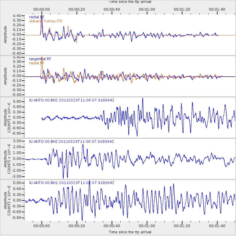
Earthquake location: Off East Coast Of Honshu, Japan
Earthquake latitude/longitude: 37.4/142.3
Earthquake time(UTC): 2011/03/29 (088) 10:54:33 GMT
Earthquake Depth: 15 km
Earthquake Magnitude: 6.1 MW, 6.1 MS, 6.1 MB, 6.1 MW
Earthquake Catalog/Contributor: NEIC PDE/NEIC PDE-M
Network: IU Global Seismograph Network (GSN - IRIS/USGS)
Station: ANTO Ankara, Turkey
Lat/Lon: 39.87 N/32.79 E
Elevation: 1090 m
Distance: 79.5 deg
Az: 312.458 deg
Baz: 49.765 deg
Ray Param: 0.04888392
Estimated Moho Depth: 33.25 km
Estimated Crust Vp/Vs: 1.77
Assumed Crust Vp: 6.159 km/s
Estimated Crust Vs: 3.47 km/s
Estimated Crust Poisson's Ratio: 0.27
Radial Match: 91.11403 %
Radial Bump: 400
Transverse Match: 88.86402 %
Transverse Bump: 400
SOD ConfigId: 558545
Insert Time: 2013-09-18 15:08:13.437 +0000
GWidth: 2.5
Max Bumps: 400
Tol: 0.001

Signal To Noise

ChannelStoNSTALTA
IU:ANTO:00:BHZ:20110329T11:06:07.918994Z5.6792813.940827E-76.9389536E-8
IU:ANTO:00:BH1:20110329T11:06:07.918994Z2.04236258.70456E-84.2620055E-8
IU:ANTO:00:BH2:20110329T11:06:07.918994Z1.29623487.01782E-85.414004E-8
Arrivals
Ps4.3 SECOND
PpPs15 SECOND
PsPs/PpSs19 SECOND