You are here: Home > Network List > CN - Canadian National Seismograph Network Stations List
> Station FRB IQALUIT, N.W.T. > Earthquake Result Viewer
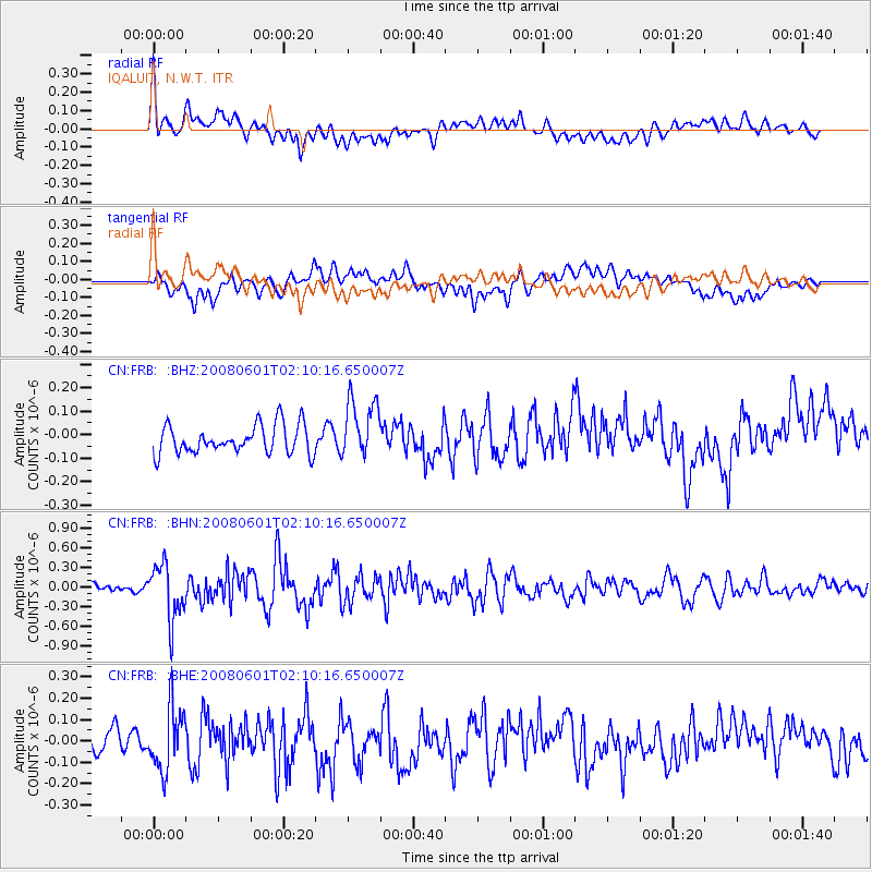
FRB IQALUIT, N.W.T. - Earthquake Result Viewer
*The percent match for this event was below the threshold and hence no stack was calculated.
| Earthquake location: |
Philippine Islands Region |
| Earthquake latitude/longitude: |
20.1/121.4 |
| Earthquake time(UTC): |
2008/06/01 (153) 01:57:24 GMT |
| Earthquake Depth: |
35 km |
| Earthquake Magnitude: |
6.0 MB, 6.2 MS, 6.3 MW, 6.2 MW |
| Earthquake Catalog/Contributor: |
WHDF/NEIC |
|
| Network: |
CN Canadian National Seismograph Network |
| Station: |
FRB IQALUIT, N.W.T. |
| Lat/Lon: |
63.75 N/68.55 W |
| Elevation: |
18 m |
|
| Distance: |
96.0 deg |
| Az: |
4.417 deg |
| Baz: |
350.635 deg |
| Ray Param: |
$rayparam |
*The percent match for this event was below the threshold and hence was not used in the summary stack. |
|
| Radial Match: |
71.27594 % |
| Radial Bump: |
400 |
| Transverse Match: |
52.42666 % |
| Transverse Bump: |
400 |
| SOD ConfigId: |
2504 |
| Insert Time: |
2010-02-27 05:55:44.815 +0000 |
| GWidth: |
2.5 |
| Max Bumps: |
400 |
| Tol: |
0.001 |
|
Signal To Noise
| Channel | StoN | STA | LTA |
| CN:FRB: :BHN:20080601T02:10:16.650007Z | 6.702731 | 4.261477E-7 | 6.357822E-8 |
| CN:FRB: :BHE:20080601T02:10:16.650007Z | 2.706012 | 1.476041E-7 | 5.4546724E-8 |
| CN:FRB: :BHZ:20080601T02:10:16.650007Z | 2.1018283 | 1.2780292E-7 | 6.08056E-8 |
| Arrivals |
| Ps | |
| PpPs | |
| PsPs/PpSs | |


