GNI Garni, Armenia - Earthquake Result Viewer
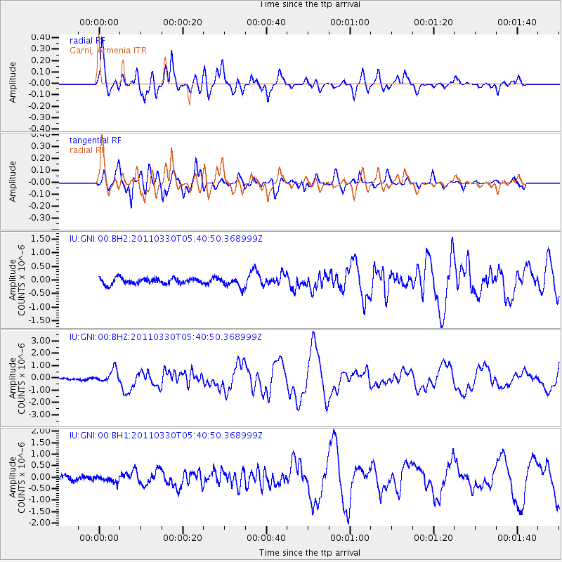
Earthquake location: Off East Coast Of Honshu, Japan
Earthquake latitude/longitude: 36.1/142.5
Earthquake time(UTC): 2011/03/30 (089) 05:29:52 GMT
Earthquake Depth: 11 km
Earthquake Magnitude: 5.7 MW, 5.6 MB, 5.8 MW, 5.8 MS
Earthquake Catalog/Contributor: NEIC PDE/NEIC PDE-M
Network: IU Global Seismograph Network (GSN - IRIS/USGS)
Station: GNI Garni, Armenia
Lat/Lon: 40.15 N/44.74 E
Elevation: 1609 m
Distance: 72.9 deg
Az: 307.381 deg
Baz: 57.046 deg
Ray Param: 0.05334407
Estimated Moho Depth: 10.0 km
Estimated Crust Vp/Vs: 1.60
Assumed Crust Vp: 6.291 km/s
Estimated Crust Vs: 3.932 km/s
Estimated Crust Poisson's Ratio: 0.18
Radial Match: 91.36439 %
Radial Bump: 400
Transverse Match: 89.3382 %
Transverse Bump: 400
SOD ConfigId: 558545
Insert Time: 2013-09-18 15:12:48.203 +0000
GWidth: 2.5
Max Bumps: 400
Tol: 0.001

Signal To Noise

ChannelStoNSTALTA
IU:GNI:00:BHZ:20110330T05:40:50.368999Z7.02290445.4888386E-77.815625E-8
IU:GNI:00:BH1:20110330T05:40:50.368999Z1.44915141.2404175E-78.559613E-8
IU:GNI:00:BH2:20110330T05:40:50.368999Z1.75223021.8616973E-71.06247306E-7
Arrivals
Ps1.0 SECOND
PpPs4.0 SECOND
PsPs/PpSs5.0 SECOND