You are here: Home > Network List > IU - Global Seismograph Network (GSN - IRIS/USGS) Stations List
> Station RSSD Black Hills, South Dakota, USA > Earthquake Result Viewer
RSSD Black Hills, South Dakota, USA - Earthquake Result Viewer
*The percent match for this event was below the threshold and hence no stack was calculated.
| Earthquake location: |
Near East Coast Of Honshu, Japan |
| Earthquake latitude/longitude: |
38.9/141.8 |
| Earthquake time(UTC): |
2011/03/31 (090) 07:15:30 GMT |
| Earthquake Depth: |
42 km |
| Earthquake Magnitude: |
6.0 MW, 5.6 MS, 5.7 MB, 6.1 MW |
| Earthquake Catalog/Contributor: |
NEIC PDE/NEIC PDE-M |
|
| Network: |
IU Global Seismograph Network (GSN - IRIS/USGS) |
| Station: |
RSSD Black Hills, South Dakota, USA |
| Lat/Lon: |
44.12 N/104.04 W |
| Elevation: |
2090 m |
|
| Distance: |
78.2 deg |
| Az: |
42.172 deg |
| Baz: |
313.351 deg |
| Ray Param: |
$rayparam |
*The percent match for this event was below the threshold and hence was not used in the summary stack. |
|
| Radial Match: |
77.81095 % |
| Radial Bump: |
400 |
| Transverse Match: |
70.97362 % |
| Transverse Bump: |
400 |
| SOD ConfigId: |
558545 |
| Insert Time: |
2013-09-18 15:18:08.702 +0000 |
| GWidth: |
2.5 |
| Max Bumps: |
400 |
| Tol: |
0.001 |
|
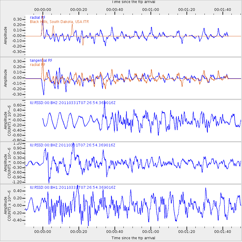
Signal To Noise
| Channel | StoN | STA | LTA |
| IU:RSSD:00:BHZ:20110331T07:26:54.369016Z | 4.5489206 | 5.9785674E-7 | 1.3142827E-7 |
| IU:RSSD:00:BH1:20110331T07:26:54.369016Z | 1.8661239 | 2.1819696E-7 | 1.1692522E-7 |
| IU:RSSD:00:BH2:20110331T07:26:54.369016Z | 1.4927251 | 2.8701226E-7 | 1.92274E-7 |
| Arrivals |
| Ps | |
| PpPs | |
| PsPs/PpSs | |


