AAK Ala Archa, Kyrgyzstan - Earthquake Result Viewer
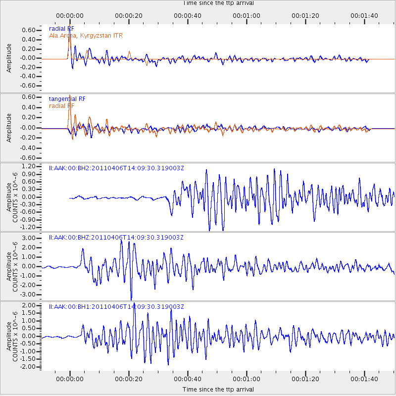
Earthquake location: Northern Sumatra, Indonesia
Earthquake latitude/longitude: 1.6/97.1
Earthquake time(UTC): 2011/04/06 (096) 14:01:42 GMT
Earthquake Depth: 20 km
Earthquake Magnitude: 6.0 MW, 5.8 MW, 5.9 MB, 6.0 MS
Earthquake Catalog/Contributor: NEIC PDE/NEIC PDE-M
Network: II Global Seismograph Network (GSN - IRIS/IDA)
Station: AAK Ala Archa, Kyrgyzstan
Lat/Lon: 42.64 N/74.49 E
Elevation: 1645 m
Distance: 45.6 deg
Az: 336.617 deg
Baz: 147.477 deg
Ray Param: 0.071155
Estimated Moho Depth: 54.25 km
Estimated Crust Vp/Vs: 1.77
Assumed Crust Vp: 6.306 km/s
Estimated Crust Vs: 3.558 km/s
Estimated Crust Poisson's Ratio: 0.27
Radial Match: 93.82426 %
Radial Bump: 400
Transverse Match: 85.645546 %
Transverse Bump: 400
SOD ConfigId: 558545
Insert Time: 2013-09-18 15:38:41.544 +0000
GWidth: 2.5
Max Bumps: 400
Tol: 0.001

Signal To Noise

ChannelStoNSTALTA
II:AAK:00:BHZ:20110406T14:09:30.319003Z12.278326.796569E-75.5354224E-8
II:AAK:00:BH1:20110406T14:09:30.319003Z6.12186862.5068755E-74.0949516E-8
II:AAK:00:BH2:20110406T14:09:30.319003Z7.4227622.4174932E-73.2568646E-8
Arrivals
Ps7.1 SECOND
PpPs22 SECOND
PsPs/PpSs30 SECOND