You are here: Home > Network List > II - Global Seismograph Network (GSN - IRIS/IDA) Stations List
> Station WRAB Tennant Creek, NT, Australia > Earthquake Result Viewer
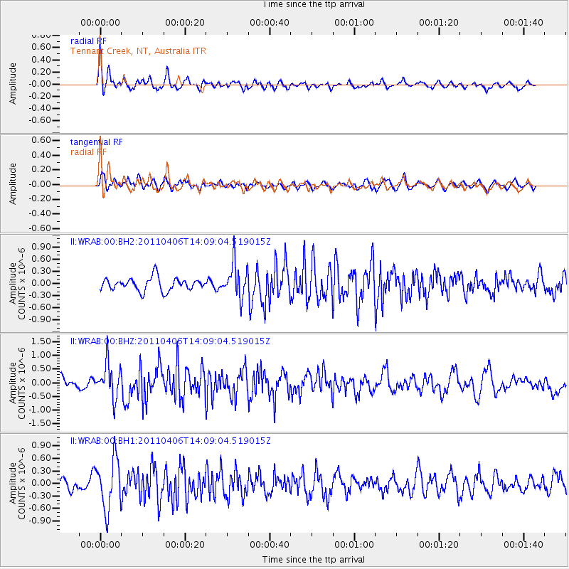
WRAB Tennant Creek, NT, Australia - Earthquake Result Viewer
*The percent match for this event was below the threshold and hence no stack was calculated.
| Earthquake location: |
Northern Sumatra, Indonesia |
| Earthquake latitude/longitude: |
1.6/97.1 |
| Earthquake time(UTC): |
2011/04/06 (096) 14:01:42 GMT |
| Earthquake Depth: |
20 km |
| Earthquake Magnitude: |
6.0 MW, 5.8 MW, 5.9 MB, 6.0 MS |
| Earthquake Catalog/Contributor: |
NEIC PDE/NEIC PDE-M |
|
| Network: |
II Global Seismograph Network (GSN - IRIS/IDA) |
| Station: |
WRAB Tennant Creek, NT, Australia |
| Lat/Lon: |
19.93 S/134.36 E |
| Elevation: |
366 m |
|
| Distance: |
42.4 deg |
| Az: |
122.264 deg |
| Baz: |
296.046 deg |
| Ray Param: |
$rayparam |
*The percent match for this event was below the threshold and hence was not used in the summary stack. |
|
| Radial Match: |
66.78679 % |
| Radial Bump: |
400 |
| Transverse Match: |
42.074795 % |
| Transverse Bump: |
393 |
| SOD ConfigId: |
558545 |
| Insert Time: |
2013-09-18 15:39:01.024 +0000 |
| GWidth: |
2.5 |
| Max Bumps: |
400 |
| Tol: |
0.001 |
|
Signal To Noise
| Channel | StoN | STA | LTA |
| II:WRAB:00:BHZ:20110406T14:09:04.519015Z | 3.031015 | 6.3668205E-7 | 2.1005573E-7 |
| II:WRAB:00:BH1:20110406T14:09:04.519015Z | 2.8890536 | 6.1018306E-7 | 2.1120518E-7 |
| II:WRAB:00:BH2:20110406T14:09:04.519015Z | 2.616204 | 4.1653428E-7 | 1.5921322E-7 |
| Arrivals |
| Ps | |
| PpPs | |
| PsPs/PpSs | |


