KURK Kurchatov, Kazakhstan - Earthquake Result Viewer
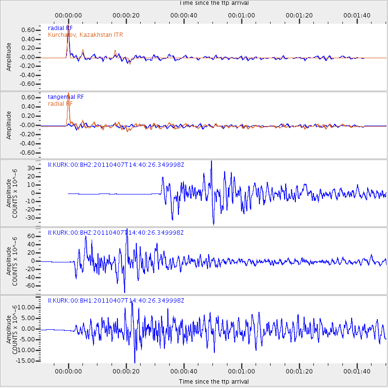
Earthquake location: Near East Coast Of Honshu, Japan
Earthquake latitude/longitude: 38.3/141.6
Earthquake time(UTC): 2011/04/07 (097) 14:32:43 GMT
Earthquake Depth: 42 km
Earthquake Magnitude: 6.9 MB, 7.0 MS, 7.1 MW, 7.1 MW
Earthquake Catalog/Contributor: WHDF/NEIC
Network: II Global Seismograph Network (GSN - IRIS/IDA)
Station: KURK Kurchatov, Kazakhstan
Lat/Lon: 50.72 N/78.62 E
Elevation: 184 m
Distance: 45.3 deg
Az: 307.167 deg
Baz: 80.601 deg
Ray Param: 0.07127592
Estimated Moho Depth: 42.0 km
Estimated Crust Vp/Vs: 1.74
Assumed Crust Vp: 6.552 km/s
Estimated Crust Vs: 3.771 km/s
Estimated Crust Poisson's Ratio: 0.25
Radial Match: 98.16556 %
Radial Bump: 325
Transverse Match: 93.16688 %
Transverse Bump: 400
SOD ConfigId: 558545
Insert Time: 2013-09-18 15:42:38.721 +0000
GWidth: 2.5
Max Bumps: 400
Tol: 0.001

Signal To Noise

ChannelStoNSTALTA
II:KURK:00:BHZ:20110407T14:40:26.349998Z47.6525081.43725865E-53.0161237E-7
II:KURK:00:BH1:20110407T14:40:26.349998Z3.96232449.364382E-72.3633558E-7
II:KURK:00:BH2:20110407T14:40:26.349998Z33.8676767.2229036E-62.1326836E-7
Arrivals
Ps5.1 SECOND
PpPs16 SECOND
PsPs/PpSs21 SECOND