FUNA Funafuti, Tuvalu - Earthquake Result Viewer
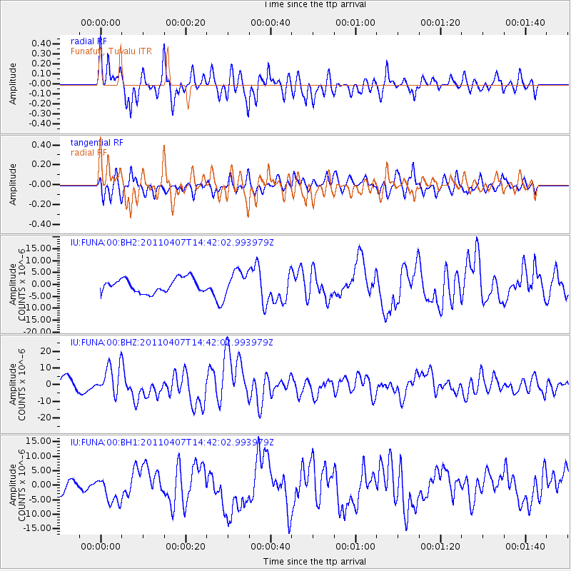
Earthquake location: Near East Coast Of Honshu, Japan
Earthquake latitude/longitude: 38.3/141.6
Earthquake time(UTC): 2011/04/07 (097) 14:32:43 GMT
Earthquake Depth: 42 km
Earthquake Magnitude: 6.9 MB, 7.0 MS, 7.1 MW, 7.1 MW
Earthquake Catalog/Contributor: WHDF/NEIC
Network: IU Global Seismograph Network (GSN - IRIS/USGS)
Station: FUNA Funafuti, Tuvalu
Lat/Lon: 8.53 S/179.20 E
Elevation: 20 m
Distance: 58.3 deg
Az: 134.794 deg
Baz: 325.62 deg
Ray Param: 0.06286356
Estimated Moho Depth: 23.0 km
Estimated Crust Vp/Vs: 1.83
Assumed Crust Vp: 4.24 km/s
Estimated Crust Vs: 2.314 km/s
Estimated Crust Poisson's Ratio: 0.29
Radial Match: 90.97117 %
Radial Bump: 400
Transverse Match: 71.42054 %
Transverse Bump: 400
SOD ConfigId: 558545
Insert Time: 2013-09-18 15:43:15.863 +0000
GWidth: 2.5
Max Bumps: 400
Tol: 0.001

Signal To Noise

ChannelStoNSTALTA
IU:FUNA:00:BHZ:20110407T14:42:02.993979Z3.05279478.975012E-62.939933E-6
IU:FUNA:00:BH1:20110407T14:42:02.993979Z1.9683014.610869E-62.3425628E-6
IU:FUNA:00:BH2:20110407T14:42:02.993979Z1.77225115.117992E-62.887848E-6
Arrivals
Ps4.6 SECOND
PpPs15 SECOND
PsPs/PpSs20 SECOND