KEV Kevo, Finland - Earthquake Result Viewer
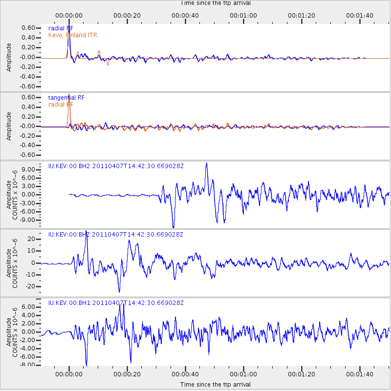
Earthquake location: Near East Coast Of Honshu, Japan
Earthquake latitude/longitude: 38.3/141.6
Earthquake time(UTC): 2011/04/07 (097) 14:32:43 GMT
Earthquake Depth: 42 km
Earthquake Magnitude: 6.9 MB, 7.0 MS, 7.1 MW, 7.1 MW
Earthquake Catalog/Contributor: WHDF/NEIC
Network: IU Global Seismograph Network (GSN - IRIS/USGS)
Station: KEV Kevo, Finland
Lat/Lon: 69.76 N/27.00 E
Elevation: 100 m
Distance: 62.3 deg
Az: 339.061 deg
Baz: 53.912 deg
Ray Param: 0.060212113
Estimated Moho Depth: 39.25 km
Estimated Crust Vp/Vs: 1.68
Assumed Crust Vp: 6.622 km/s
Estimated Crust Vs: 3.942 km/s
Estimated Crust Poisson's Ratio: 0.23
Radial Match: 97.393234 %
Radial Bump: 400
Transverse Match: 85.90192 %
Transverse Bump: 400
SOD ConfigId: 558545
Insert Time: 2013-09-18 15:43:34.116 +0000
GWidth: 2.5
Max Bumps: 400
Tol: 0.001

Signal To Noise

ChannelStoNSTALTA
IU:KEV:00:BHZ:20110407T14:42:30.669028Z9.2863243.4230507E-63.6861204E-7
IU:KEV:00:BH1:20110407T14:42:30.669028Z3.1426248.754689E-72.7857897E-7
IU:KEV:00:BH2:20110407T14:42:30.669028Z6.1442051.3382953E-62.1781423E-7
Arrivals
Ps4.2 SECOND
PpPs15 SECOND
PsPs/PpSs19 SECOND