
PMG Port Moresby, New Guinea - Earthquake Result Viewer
| ||||||||||||||||||
| ||||||||||||||||||
| ||||||||||||||||||
|
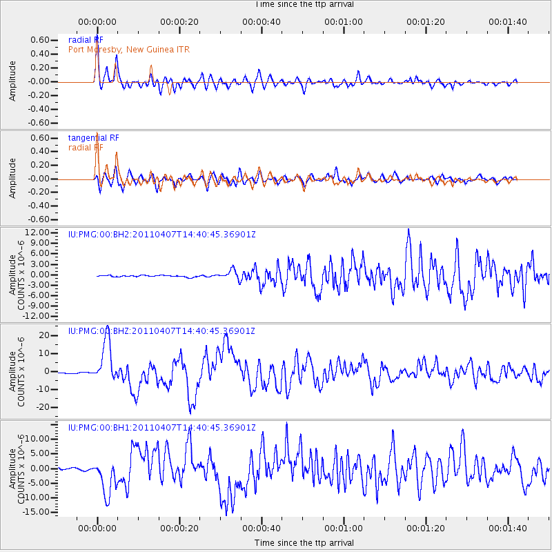
Signal To Noise
| Channel | StoN | STA | LTA |
| IU:PMG:00:BHZ:20110407T14:40:45.36901Z | 61.57029 | 1.2364966E-5 | 2.0082682E-7 |
| IU:PMG:00:BH1:20110407T14:40:45.36901Z | 17.555517 | 6.440131E-6 | 3.668437E-7 |
| IU:PMG:00:BH2:20110407T14:40:45.36901Z | 6.3281875 | 1.3799944E-6 | 2.1807104E-7 |
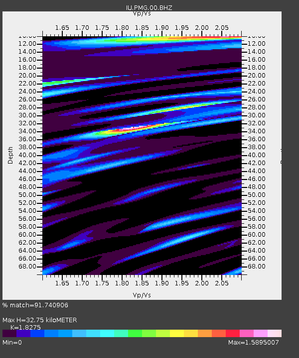
| Arrivals | |
| Ps | 4.7 SECOND |
| PpPs | 14 SECOND |
| PsPs/PpSs | 19 SECOND |

