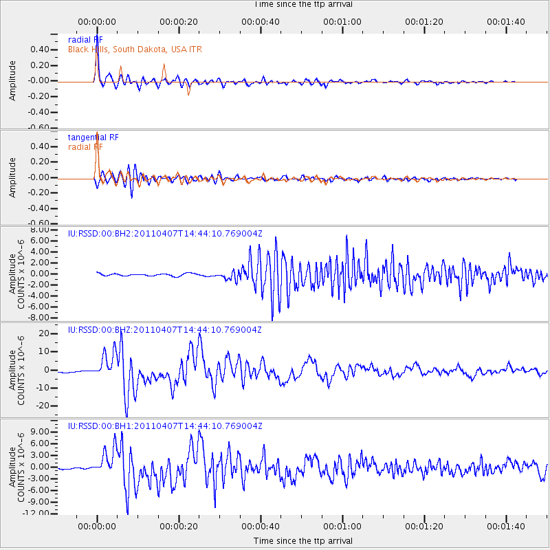
RSSD Black Hills, South Dakota, USA - Earthquake Result Viewer
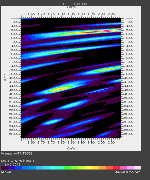
Earthquake location: Near East Coast Of Honshu, Japan
Earthquake latitude/longitude: 38.3/141.6
Earthquake time(UTC): 2011/04/07 (097) 14:32:43 GMT
Earthquake Depth: 42 km
Earthquake Magnitude: 6.9 MB, 7.0 MS, 7.1 MW, 7.1 MW
Earthquake Catalog/Contributor: WHDF/NEIC
Network: IU Global Seismograph Network (GSN - IRIS/USGS)
Station: RSSD Black Hills, South Dakota, USA
Lat/Lon: 44.12 N/104.04 W
Elevation: 2090 m
Distance: 78.8 deg
Az: 41.967 deg
Baz: 313.048 deg
Ray Param: 0.04931973
Estimated Moho Depth: 15.75 km
Estimated Crust Vp/Vs: 2.10
Assumed Crust Vp: 6.242 km/s
Estimated Crust Vs: 2.976 km/s
Estimated Crust Poisson's Ratio: 0.35
Radial Match: 97.45083 %
Radial Bump: 400
Transverse Match: 92.19889 %
Transverse Bump: 400
SOD ConfigId: 558545
Insert Time: 2013-09-18 15:44:00.901 +0000
GWidth: 2.5
Max Bumps: 400
Tol: 0.001

Signal To Noise

ChannelStoNSTALTA
IU:RSSD:00:BHZ:20110407T14:44:10.769004Z21.667057.597949E-63.506684E-7
IU:RSSD:00:BH1:20110407T14:44:10.769004Z16.5314963.6773965E-62.2244791E-7
IU:RSSD:00:BH2:20110407T14:44:10.769004Z3.50721457.426543E-72.1175046E-7
Arrivals
Ps2.8 SECOND
PpPs7.6 SECOND
PsPs/PpSs10 SECOND