You are here: Home > Network List > IU - Global Seismograph Network (GSN - IRIS/USGS) Stations List
> Station PMG Port Moresby, New Guinea > Earthquake Result Viewer
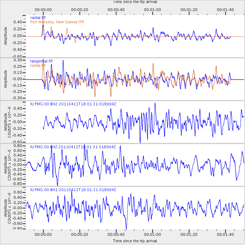
PMG Port Moresby, New Guinea - Earthquake Result Viewer
*The percent match for this event was below the threshold and hence no stack was calculated.
| Earthquake location: |
Off East Coast Of Honshu, Japan |
| Earthquake latitude/longitude: |
37.6/144.5 |
| Earthquake time(UTC): |
2011/04/11 (101) 17:53:32 GMT |
| Earthquake Depth: |
12 km |
| Earthquake Magnitude: |
5.5 MW, 5.7 MB |
| Earthquake Catalog/Contributor: |
NEIC PDE/NEIC PDE-M |
|
| Network: |
IU Global Seismograph Network (GSN - IRIS/USGS) |
| Station: |
PMG Port Moresby, New Guinea |
| Lat/Lon: |
9.40 S/147.16 E |
| Elevation: |
90 m |
|
| Distance: |
46.9 deg |
| Az: |
176.362 deg |
| Baz: |
357.074 deg |
| Ray Param: |
$rayparam |
*The percent match for this event was below the threshold and hence was not used in the summary stack. |
|
| Radial Match: |
57.837906 % |
| Radial Bump: |
400 |
| Transverse Match: |
59.15995 % |
| Transverse Bump: |
400 |
| SOD ConfigId: |
558545 |
| Insert Time: |
2013-09-18 15:54:44.351 +0000 |
| GWidth: |
2.5 |
| Max Bumps: |
400 |
| Tol: |
0.001 |
|
Signal To Noise
| Channel | StoN | STA | LTA |
| IU:PMG:00:BHZ:20110411T18:01:31.018994Z | 1.8235164 | 2.9591706E-7 | 1.6227825E-7 |
| IU:PMG:00:BH1:20110411T18:01:31.018994Z | 1.118615 | 1.9230663E-7 | 1.7191493E-7 |
| IU:PMG:00:BH2:20110411T18:01:31.018994Z | 0.96471894 | 1.141894E-7 | 1.18365456E-7 |
| Arrivals |
| Ps | |
| PpPs | |
| PsPs/PpSs | |


