You are here: Home > Network List > IU - Global Seismograph Network (GSN - IRIS/USGS) Stations List
> Station HNR Honiara, Solomon Islands > Earthquake Result Viewer
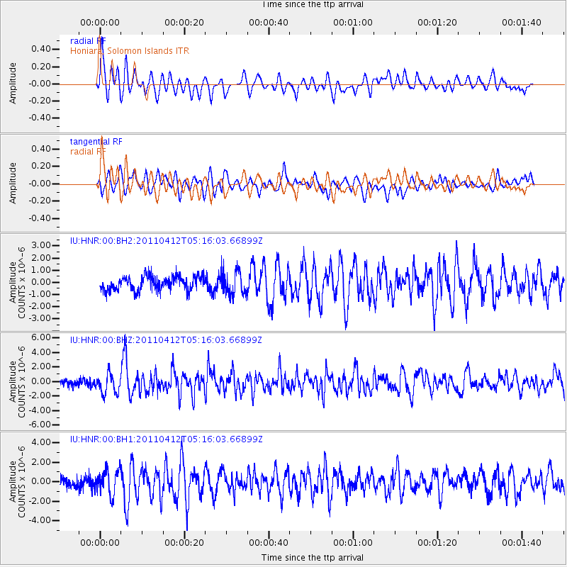
HNR Honiara, Solomon Islands - Earthquake Result Viewer
*The percent match for this event was below the threshold and hence no stack was calculated.
| Earthquake location: |
Eastern Honshu, Japan |
| Earthquake latitude/longitude: |
37.1/140.4 |
| Earthquake time(UTC): |
2011/04/12 (102) 05:07:41 GMT |
| Earthquake Depth: |
11 km |
| Earthquake Magnitude: |
6.3 MB, 5.7 MS, 6.0 MW, 5.9 MW |
| Earthquake Catalog/Contributor: |
WHDF/NEIC |
|
| Network: |
IU Global Seismograph Network (GSN - IRIS/USGS) |
| Station: |
HNR Honiara, Solomon Islands |
| Lat/Lon: |
9.44 S/159.95 E |
| Elevation: |
100 m |
|
| Distance: |
49.8 deg |
| Az: |
154.354 deg |
| Baz: |
339.47 deg |
| Ray Param: |
$rayparam |
*The percent match for this event was below the threshold and hence was not used in the summary stack. |
|
| Radial Match: |
63.482704 % |
| Radial Bump: |
400 |
| Transverse Match: |
56.77631 % |
| Transverse Bump: |
400 |
| SOD ConfigId: |
558545 |
| Insert Time: |
2013-09-18 15:59:53.107 +0000 |
| GWidth: |
2.5 |
| Max Bumps: |
400 |
| Tol: |
0.001 |
|
Signal To Noise
| Channel | StoN | STA | LTA |
| IU:HNR:00:BHZ:20110412T05:16:03.66899Z | 2.2593884 | 1.3741762E-6 | 6.082072E-7 |
| IU:HNR:00:BH1:20110412T05:16:03.66899Z | 2.188511 | 1.2653254E-6 | 5.7816726E-7 |
| IU:HNR:00:BH2:20110412T05:16:03.66899Z | 1.6069545 | 9.2627914E-7 | 5.7641904E-7 |
| Arrivals |
| Ps | |
| PpPs | |
| PsPs/PpSs | |


