You are here: Home > Network List > II - Global Seismograph Network (GSN - IRIS/IDA) Stations List
> Station WRAB Tennant Creek, NT, Australia > Earthquake Result Viewer
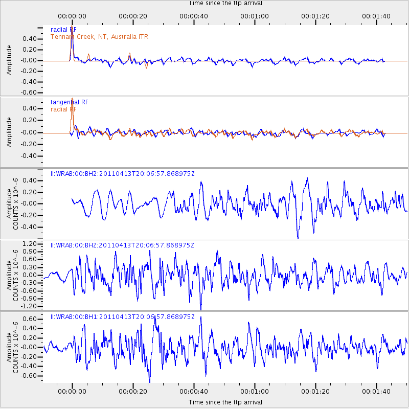
WRAB Tennant Creek, NT, Australia - Earthquake Result Viewer
*The percent match for this event was below the threshold and hence no stack was calculated.
| Earthquake location: |
Off East Coast Of Honshu, Japan |
| Earthquake latitude/longitude: |
39.6/143.3 |
| Earthquake time(UTC): |
2011/04/13 (103) 19:57:25 GMT |
| Earthquake Depth: |
22 km |
| Earthquake Magnitude: |
6.0 MW, 5.8 MB, 6.0 MS, 6.1 MW |
| Earthquake Catalog/Contributor: |
NEIC PDE/NEIC PDE-M |
|
| Network: |
II Global Seismograph Network (GSN - IRIS/IDA) |
| Station: |
WRAB Tennant Creek, NT, Australia |
| Lat/Lon: |
19.93 S/134.36 E |
| Elevation: |
366 m |
|
| Distance: |
59.8 deg |
| Az: |
189.783 deg |
| Baz: |
8.023 deg |
| Ray Param: |
$rayparam |
*The percent match for this event was below the threshold and hence was not used in the summary stack. |
|
| Radial Match: |
71.06475 % |
| Radial Bump: |
400 |
| Transverse Match: |
45.53113 % |
| Transverse Bump: |
400 |
| SOD ConfigId: |
558545 |
| Insert Time: |
2013-09-18 16:04:10.999 +0000 |
| GWidth: |
2.5 |
| Max Bumps: |
400 |
| Tol: |
0.001 |
|
Signal To Noise
| Channel | StoN | STA | LTA |
| II:WRAB:00:BHZ:20110413T20:06:57.868975Z | 3.126782 | 4.510657E-7 | 1.4425876E-7 |
| II:WRAB:00:BH1:20110413T20:06:57.868975Z | 2.5889664 | 2.5954535E-7 | 1.0025057E-7 |
| II:WRAB:00:BH2:20110413T20:06:57.868975Z | 1.1997732 | 1.572244E-7 | 1.310451E-7 |
| Arrivals |
| Ps | |
| PpPs | |
| PsPs/PpSs | |


