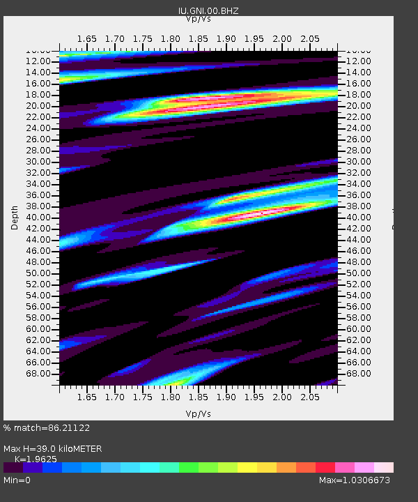
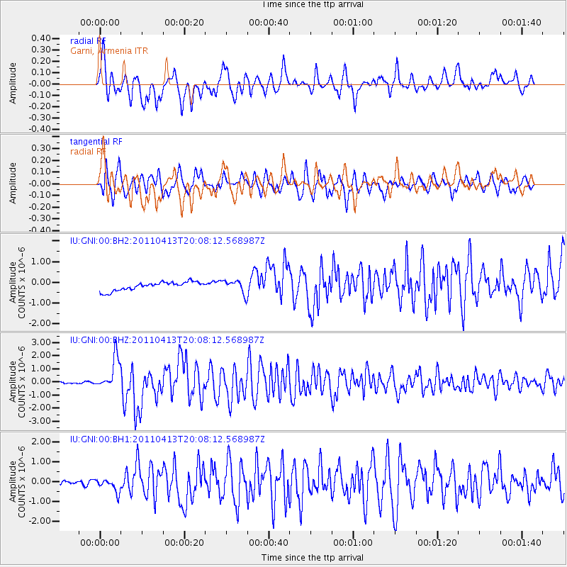
GNI Garni, Armenia - Earthquake Result Viewer

Earthquake location: Off East Coast Of Honshu, Japan
Earthquake latitude/longitude: 39.6/143.3
Earthquake time(UTC): 2011/04/13 (103) 19:57:25 GMT
Earthquake Depth: 22 km
Earthquake Magnitude: 6.0 MW, 5.8 MB, 6.0 MS, 6.1 MW
Earthquake Catalog/Contributor: NEIC PDE/NEIC PDE-M
Network: IU Global Seismograph Network (GSN - IRIS/USGS)
Station: GNI Garni, Armenia
Lat/Lon: 40.15 N/44.74 E
Elevation: 1609 m
Distance: 71.4 deg
Az: 306.9 deg
Baz: 53.73 deg
Ray Param: 0.054331727
Estimated Moho Depth: 39.0 km
Estimated Crust Vp/Vs: 1.96
Assumed Crust Vp: 6.291 km/s
Estimated Crust Vs: 3.205 km/s
Estimated Crust Poisson's Ratio: 0.32
Radial Match: 86.21122 %
Radial Bump: 400
Transverse Match: 77.3862 %
Transverse Bump: 400
SOD ConfigId: 558545
Insert Time: 2013-09-18 16:04:41.513 +0000
GWidth: 2.5
Max Bumps: 400
Tol: 0.001

Signal To Noise

ChannelStoNSTALTA
IU:GNI:00:BHZ:20110413T20:08:12.568987Z15.4910941.2725188E-68.2145185E-8
IU:GNI:00:BH1:20110413T20:08:12.568987Z2.80765943.4583704E-71.2317628E-7
IU:GNI:00:BH2:20110413T20:08:12.568987Z1.60618323.2729494E-72.0377188E-7
Arrivals
Ps6.2 SECOND
PpPs18 SECOND
PsPs/PpSs24 SECOND