You are here: Home > Network List > IU - Global Seismograph Network (GSN - IRIS/USGS) Stations List
> Station PMG Port Moresby, New Guinea > Earthquake Result Viewer
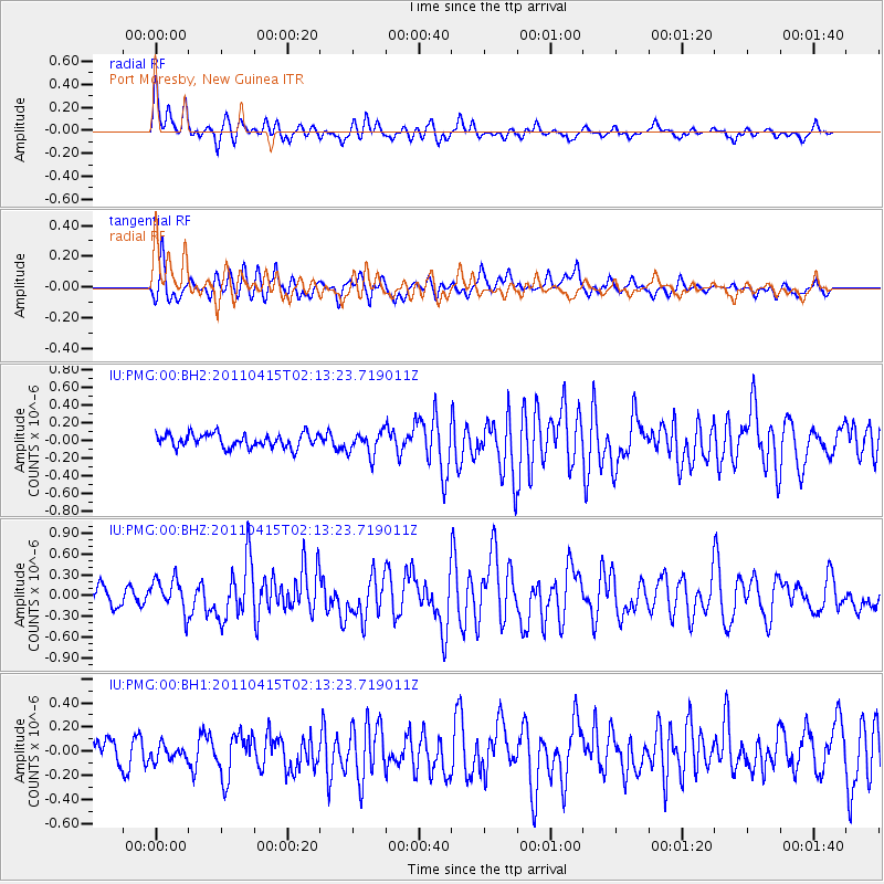
PMG Port Moresby, New Guinea - Earthquake Result Viewer
*The percent match for this event was below the threshold and hence no stack was calculated.
| Earthquake location: |
Tonga Islands |
| Earthquake latitude/longitude: |
-15.3/-173.2 |
| Earthquake time(UTC): |
2011/04/15 (105) 02:06:28 GMT |
| Earthquake Depth: |
17 km |
| Earthquake Magnitude: |
5.8 MW, 5.7 MS, 5.8 MB, 5.8 MW |
| Earthquake Catalog/Contributor: |
NEIC PDE/NEIC PDE-M |
|
| Network: |
IU Global Seismograph Network (GSN - IRIS/USGS) |
| Station: |
PMG Port Moresby, New Guinea |
| Lat/Lon: |
9.40 S/147.16 E |
| Elevation: |
90 m |
|
| Distance: |
39.1 deg |
| Az: |
273.861 deg |
| Baz: |
102.618 deg |
| Ray Param: |
$rayparam |
*The percent match for this event was below the threshold and hence was not used in the summary stack. |
|
| Radial Match: |
71.92366 % |
| Radial Bump: |
400 |
| Transverse Match: |
71.888824 % |
| Transverse Bump: |
400 |
| SOD ConfigId: |
558545 |
| Insert Time: |
2013-09-18 16:14:49.805 +0000 |
| GWidth: |
2.5 |
| Max Bumps: |
400 |
| Tol: |
0.001 |
|
Signal To Noise
| Channel | StoN | STA | LTA |
| IU:PMG:00:BHZ:20110415T02:13:23.719011Z | 1.8655714 | 2.3915177E-7 | 1.2819226E-7 |
| IU:PMG:00:BH1:20110415T02:13:23.719011Z | 0.7654533 | 6.7719526E-8 | 8.846984E-8 |
| IU:PMG:00:BH2:20110415T02:13:23.719011Z | 1.7122573 | 1.3166212E-7 | 7.689389E-8 |
| Arrivals |
| Ps | |
| PpPs | |
| PsPs/PpSs | |


