You are here: Home > Network List > IU - Global Seismograph Network (GSN - IRIS/USGS) Stations List
> Station HNR Honiara, Solomon Islands > Earthquake Result Viewer
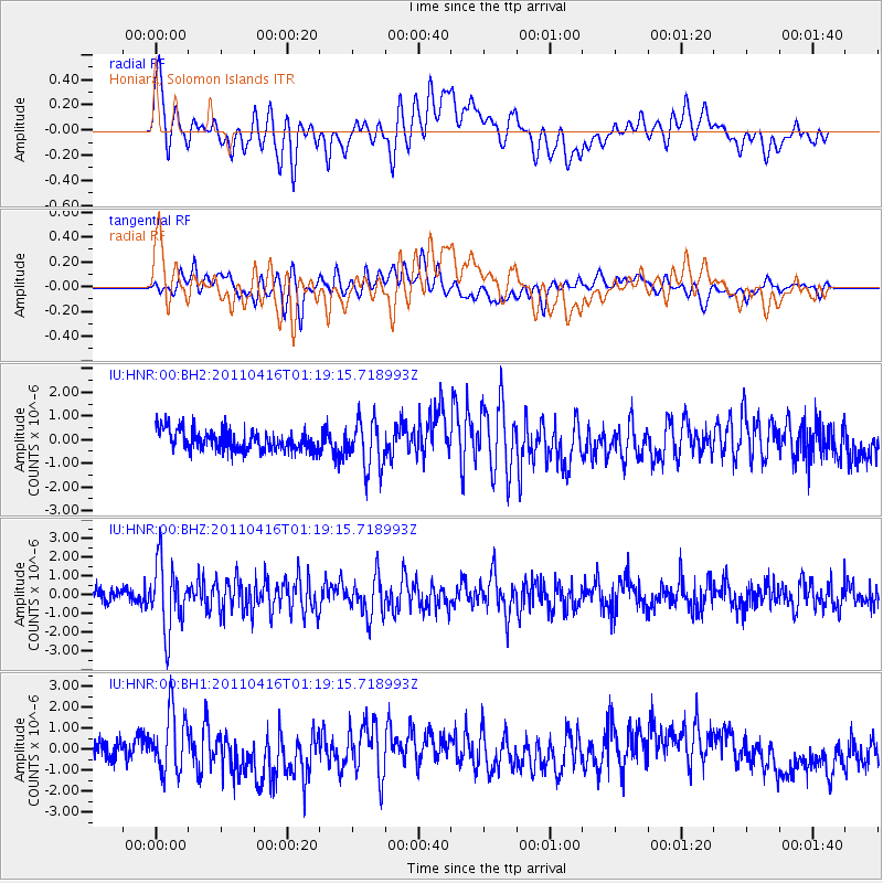
HNR Honiara, Solomon Islands - Earthquake Result Viewer
*The percent match for this event was below the threshold and hence no stack was calculated.
| Earthquake location: |
Northeast Of Taiwan |
| Earthquake latitude/longitude: |
25.4/123.9 |
| Earthquake time(UTC): |
2011/04/16 (106) 01:11:10 GMT |
| Earthquake Depth: |
134 km |
| Earthquake Magnitude: |
5.9 MB, 5.8 MW, 5.8 MW |
| Earthquake Catalog/Contributor: |
WHDF/NEIC |
|
| Network: |
IU Global Seismograph Network (GSN - IRIS/USGS) |
| Station: |
HNR Honiara, Solomon Islands |
| Lat/Lon: |
9.44 S/159.95 E |
| Elevation: |
100 m |
|
| Distance: |
49.3 deg |
| Az: |
130.035 deg |
| Baz: |
315.434 deg |
| Ray Param: |
$rayparam |
*The percent match for this event was below the threshold and hence was not used in the summary stack. |
|
| Radial Match: |
52.130413 % |
| Radial Bump: |
400 |
| Transverse Match: |
59.36306 % |
| Transverse Bump: |
400 |
| SOD ConfigId: |
558545 |
| Insert Time: |
2013-09-18 16:19:19.002 +0000 |
| GWidth: |
2.5 |
| Max Bumps: |
400 |
| Tol: |
0.001 |
|
Signal To Noise
| Channel | StoN | STA | LTA |
| IU:HNR:00:BHZ:20110416T01:19:15.718993Z | 4.342873 | 1.8009638E-6 | 4.1469409E-7 |
| IU:HNR:00:BH1:20110416T01:19:15.718993Z | 3.2870393 | 1.4322303E-6 | 4.3572044E-7 |
| IU:HNR:00:BH2:20110416T01:19:15.718993Z | 2.284268 | 1.0112303E-6 | 4.426934E-7 |
| Arrivals |
| Ps | |
| PpPs | |
| PsPs/PpSs | |


