You are here: Home > Network List > II - Global Seismograph Network (GSN - IRIS/IDA) Stations List
> Station WRAB Tennant Creek, NT, Australia > Earthquake Result Viewer
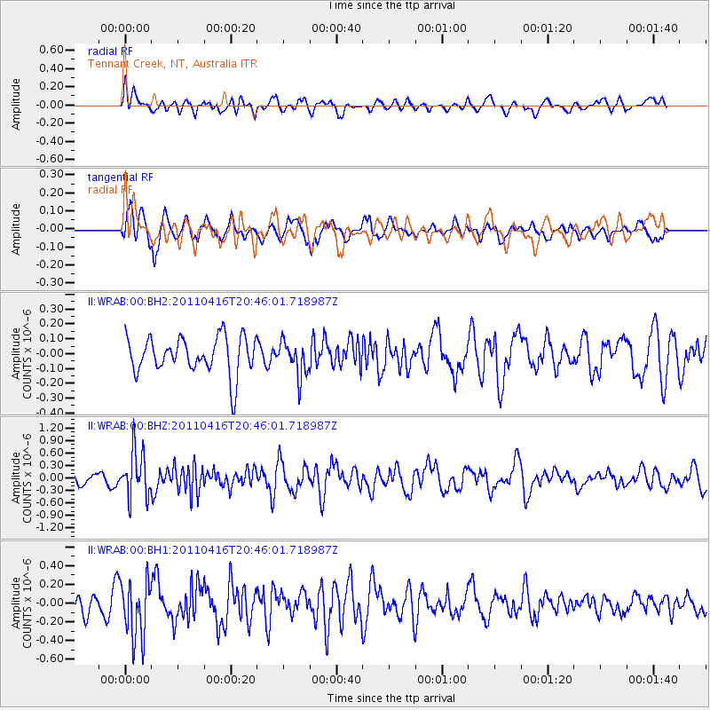
WRAB Tennant Creek, NT, Australia - Earthquake Result Viewer
*The percent match for this event was below the threshold and hence no stack was calculated.
| Earthquake location: |
Off East Coast Of Honshu, Japan |
| Earthquake latitude/longitude: |
36.9/143.9 |
| Earthquake time(UTC): |
2011/04/16 (106) 20:36:46 GMT |
| Earthquake Depth: |
15 km |
| Earthquake Magnitude: |
5.5 MW, 5.5 MW, 5.8 MB |
| Earthquake Catalog/Contributor: |
NEIC PDE/NEIC PDE-M |
|
| Network: |
II Global Seismograph Network (GSN - IRIS/IDA) |
| Station: |
WRAB Tennant Creek, NT, Australia |
| Lat/Lon: |
19.93 S/134.36 E |
| Elevation: |
366 m |
|
| Distance: |
57.2 deg |
| Az: |
190.707 deg |
| Baz: |
9.111 deg |
| Ray Param: |
$rayparam |
*The percent match for this event was below the threshold and hence was not used in the summary stack. |
|
| Radial Match: |
51.590218 % |
| Radial Bump: |
400 |
| Transverse Match: |
65.31207 % |
| Transverse Bump: |
400 |
| SOD ConfigId: |
558545 |
| Insert Time: |
2013-09-18 16:23:48.931 +0000 |
| GWidth: |
2.5 |
| Max Bumps: |
400 |
| Tol: |
0.001 |
|
Signal To Noise
| Channel | StoN | STA | LTA |
| II:WRAB:00:BHZ:20110416T20:46:01.718987Z | 3.8110137 | 5.625585E-7 | 1.4761387E-7 |
| II:WRAB:00:BH1:20110416T20:46:01.718987Z | 2.2113433 | 3.101244E-7 | 1.4024253E-7 |
| II:WRAB:00:BH2:20110416T20:46:01.718987Z | 0.95104265 | 1.170254E-7 | 1.2304959E-7 |
| Arrivals |
| Ps | |
| PpPs | |
| PsPs/PpSs | |


