You are here: Home > Network List > IU - Global Seismograph Network (GSN - IRIS/USGS) Stations List
> Station RSSD Black Hills, South Dakota, USA > Earthquake Result Viewer
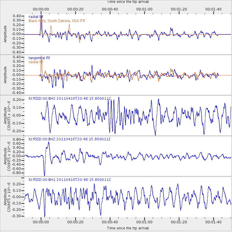
RSSD Black Hills, South Dakota, USA - Earthquake Result Viewer
*The percent match for this event was below the threshold and hence no stack was calculated.
| Earthquake location: |
Off East Coast Of Honshu, Japan |
| Earthquake latitude/longitude: |
36.9/143.9 |
| Earthquake time(UTC): |
2011/04/16 (106) 20:36:46 GMT |
| Earthquake Depth: |
15 km |
| Earthquake Magnitude: |
5.5 MW, 5.5 MW, 5.8 MB |
| Earthquake Catalog/Contributor: |
NEIC PDE/NEIC PDE-M |
|
| Network: |
IU Global Seismograph Network (GSN - IRIS/USGS) |
| Station: |
RSSD Black Hills, South Dakota, USA |
| Lat/Lon: |
44.12 N/104.04 W |
| Elevation: |
2090 m |
|
| Distance: |
78.6 deg |
| Az: |
42.921 deg |
| Baz: |
310.695 deg |
| Ray Param: |
$rayparam |
*The percent match for this event was below the threshold and hence was not used in the summary stack. |
|
| Radial Match: |
64.698784 % |
| Radial Bump: |
400 |
| Transverse Match: |
67.9387 % |
| Transverse Bump: |
400 |
| SOD ConfigId: |
558545 |
| Insert Time: |
2013-09-18 16:24:38.033 +0000 |
| GWidth: |
2.5 |
| Max Bumps: |
400 |
| Tol: |
0.001 |
|
Signal To Noise
| Channel | StoN | STA | LTA |
| IU:RSSD:00:BHZ:20110416T20:48:15.869011Z | 6.3727174 | 4.2591304E-7 | 6.683382E-8 |
| IU:RSSD:00:BH1:20110416T20:48:15.869011Z | 1.6216499 | 1.2955665E-7 | 7.989188E-8 |
| IU:RSSD:00:BH2:20110416T20:48:15.869011Z | 0.7381762 | 5.910839E-8 | 8.007355E-8 |
| Arrivals |
| Ps | |
| PpPs | |
| PsPs/PpSs | |


