You are here: Home > Network List > IU - Global Seismograph Network (GSN - IRIS/USGS) Stations List
> Station GUMO Guam, Mariana Islands > Earthquake Result Viewer
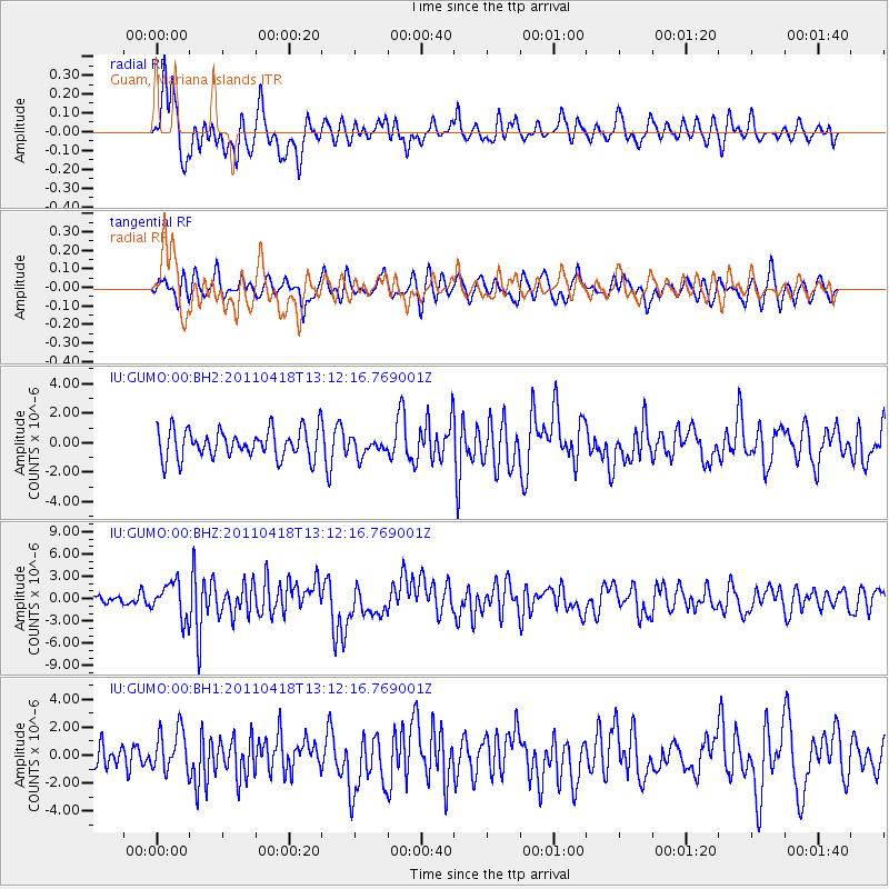
GUMO Guam, Mariana Islands - Earthquake Result Viewer
*The percent match for this event was below the threshold and hence no stack was calculated.
| Earthquake location: |
South Of Kermadec Islands |
| Earthquake latitude/longitude: |
-34.3/179.9 |
| Earthquake time(UTC): |
2011/04/18 (108) 13:03:02 GMT |
| Earthquake Depth: |
86 km |
| Earthquake Magnitude: |
6.2 MB, 6.6 MW, 6.5 MW |
| Earthquake Catalog/Contributor: |
WHDF/NEIC |
|
| Network: |
IU Global Seismograph Network (GSN - IRIS/USGS) |
| Station: |
GUMO Guam, Mariana Islands |
| Lat/Lon: |
13.59 N/144.87 E |
| Elevation: |
170 m |
|
| Distance: |
58.1 deg |
| Az: |
318.943 deg |
| Baz: |
146.016 deg |
| Ray Param: |
$rayparam |
*The percent match for this event was below the threshold and hence was not used in the summary stack. |
|
| Radial Match: |
76.43258 % |
| Radial Bump: |
400 |
| Transverse Match: |
57.236473 % |
| Transverse Bump: |
400 |
| SOD ConfigId: |
558545 |
| Insert Time: |
2013-09-18 16:31:25.951 +0000 |
| GWidth: |
2.5 |
| Max Bumps: |
400 |
| Tol: |
0.001 |
|
Signal To Noise
| Channel | StoN | STA | LTA |
| IU:GUMO:00:BHZ:20110418T13:12:16.769001Z | 2.8956392 | 2.3808452E-6 | 8.2221754E-7 |
| IU:GUMO:00:BH1:20110418T13:12:16.769001Z | 1.9533962 | 1.5233608E-6 | 7.798524E-7 |
| IU:GUMO:00:BH2:20110418T13:12:16.769001Z | 0.60747206 | 5.867728E-7 | 9.659256E-7 |
| Arrivals |
| Ps | |
| PpPs | |
| PsPs/PpSs | |


