You are here: Home > Network List > IU - Global Seismograph Network (GSN - IRIS/USGS) Stations List
> Station HNR Honiara, Solomon Islands > Earthquake Result Viewer
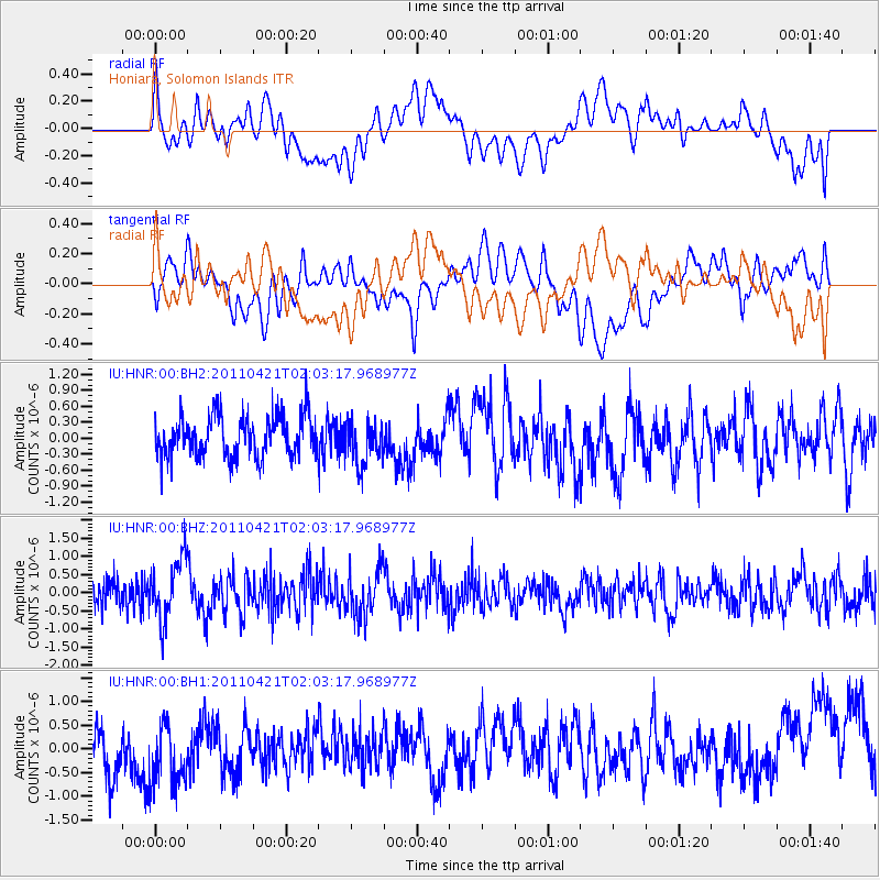
HNR Honiara, Solomon Islands - Earthquake Result Viewer
*The percent match for this event was below the threshold and hence no stack was calculated.
| Earthquake location: |
Off East Coast Of Honshu, Japan |
| Earthquake latitude/longitude: |
40.3/143.6 |
| Earthquake time(UTC): |
2011/04/21 (111) 01:54:41 GMT |
| Earthquake Depth: |
11 km |
| Earthquake Magnitude: |
5.8 MW, 5.5 MS, 5.7 MB, 5.8 MW |
| Earthquake Catalog/Contributor: |
NEIC PDE/NEIC PDE-M |
|
| Network: |
IU Global Seismograph Network (GSN - IRIS/USGS) |
| Station: |
HNR Honiara, Solomon Islands |
| Lat/Lon: |
9.44 S/159.95 E |
| Elevation: |
100 m |
|
| Distance: |
51.7 deg |
| Az: |
159.326 deg |
| Baz: |
344.119 deg |
| Ray Param: |
$rayparam |
*The percent match for this event was below the threshold and hence was not used in the summary stack. |
|
| Radial Match: |
40.211704 % |
| Radial Bump: |
400 |
| Transverse Match: |
38.586773 % |
| Transverse Bump: |
400 |
| SOD ConfigId: |
558545 |
| Insert Time: |
2013-09-18 16:37:41.700 +0000 |
| GWidth: |
2.5 |
| Max Bumps: |
400 |
| Tol: |
0.001 |
|
Signal To Noise
| Channel | StoN | STA | LTA |
| IU:HNR:00:BHZ:20110421T02:03:17.968977Z | 2.919121 | 8.4463824E-7 | 2.8934676E-7 |
| IU:HNR:00:BH1:20110421T02:03:17.968977Z | 1.7451284 | 6.4933477E-7 | 3.720842E-7 |
| IU:HNR:00:BH2:20110421T02:03:17.968977Z | 1.0785323 | 4.1005453E-7 | 3.8019678E-7 |
| Arrivals |
| Ps | |
| PpPs | |
| PsPs/PpSs | |


