You are here: Home > Network List > IU - Global Seismograph Network (GSN - IRIS/USGS) Stations List
> Station PMG Port Moresby, New Guinea > Earthquake Result Viewer
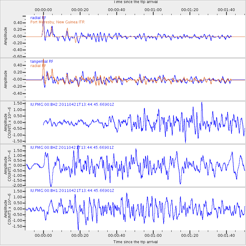
PMG Port Moresby, New Guinea - Earthquake Result Viewer
*The percent match for this event was below the threshold and hence no stack was calculated.
| Earthquake location: |
Near East Coast Of Honshu, Japan |
| Earthquake latitude/longitude: |
35.6/140.3 |
| Earthquake time(UTC): |
2011/04/21 (111) 13:37:03 GMT |
| Earthquake Depth: |
43 km |
| Earthquake Magnitude: |
6.2 MW, 5.7 MB, 5.8 MS, 6.2 MW |
| Earthquake Catalog/Contributor: |
NEIC PDE/NEIC PDE-M |
|
| Network: |
IU Global Seismograph Network (GSN - IRIS/USGS) |
| Station: |
PMG Port Moresby, New Guinea |
| Lat/Lon: |
9.40 S/147.16 E |
| Elevation: |
90 m |
|
| Distance: |
45.2 deg |
| Az: |
170.447 deg |
| Baz: |
352.12 deg |
| Ray Param: |
$rayparam |
*The percent match for this event was below the threshold and hence was not used in the summary stack. |
|
| Radial Match: |
76.7134 % |
| Radial Bump: |
400 |
| Transverse Match: |
68.75595 % |
| Transverse Bump: |
400 |
| SOD ConfigId: |
558545 |
| Insert Time: |
2013-09-18 16:39:55.416 +0000 |
| GWidth: |
2.5 |
| Max Bumps: |
400 |
| Tol: |
0.001 |
|
Signal To Noise
| Channel | StoN | STA | LTA |
| IU:PMG:00:BHZ:20110421T13:44:45.66901Z | 7.857605 | 1.1230032E-6 | 1.4291929E-7 |
| IU:PMG:00:BH1:20110421T13:44:45.66901Z | 4.675539 | 4.819985E-7 | 1.0308939E-7 |
| IU:PMG:00:BH2:20110421T13:44:45.66901Z | 1.3092341 | 1.8512833E-7 | 1.41402E-7 |
| Arrivals |
| Ps | |
| PpPs | |
| PsPs/PpSs | |


