You are here: Home > Network List > IU - Global Seismograph Network (GSN - IRIS/USGS) Stations List
> Station MAJO Matsushiro, Japan > Earthquake Result Viewer
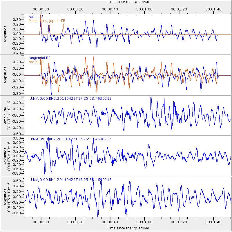
MAJO Matsushiro, Japan - Earthquake Result Viewer
*The percent match for this event was below the threshold and hence no stack was calculated.
| Earthquake location: |
Tonga Islands Region |
| Earthquake latitude/longitude: |
-22.8/-174.6 |
| Earthquake time(UTC): |
2011/04/22 (112) 17:14:51 GMT |
| Earthquake Depth: |
22 km |
| Earthquake Magnitude: |
5.5 MB, 5.2 MS, 5.5 MW |
| Earthquake Catalog/Contributor: |
WHDF/NEIC |
|
| Network: |
IU Global Seismograph Network (GSN - IRIS/USGS) |
| Station: |
MAJO Matsushiro, Japan |
| Lat/Lon: |
36.55 N/138.20 E |
| Elevation: |
405 m |
|
| Distance: |
74.0 deg |
| Az: |
322.059 deg |
| Baz: |
135.208 deg |
| Ray Param: |
$rayparam |
*The percent match for this event was below the threshold and hence was not used in the summary stack. |
|
| Radial Match: |
62.009342 % |
| Radial Bump: |
400 |
| Transverse Match: |
55.148952 % |
| Transverse Bump: |
390 |
| SOD ConfigId: |
558545 |
| Insert Time: |
2013-09-18 16:46:26.741 +0000 |
| GWidth: |
2.5 |
| Max Bumps: |
400 |
| Tol: |
0.001 |
|
Signal To Noise
| Channel | StoN | STA | LTA |
| IU:MAJO:00:BHZ:20110422T17:25:53.469021Z | 2.679171 | 4.8168715E-7 | 1.7978962E-7 |
| IU:MAJO:00:BH1:20110422T17:25:53.469021Z | 0.90490234 | 1.6396245E-7 | 1.8119354E-7 |
| IU:MAJO:00:BH2:20110422T17:25:53.469021Z | 1.3398551 | 1.8133018E-7 | 1.3533567E-7 |
| Arrivals |
| Ps | |
| PpPs | |
| PsPs/PpSs | |


