You are here: Home > Network List > IU - Global Seismograph Network (GSN - IRIS/USGS) Stations List
> Station POHA Pohakuloa, Hawaii, USA > Earthquake Result Viewer
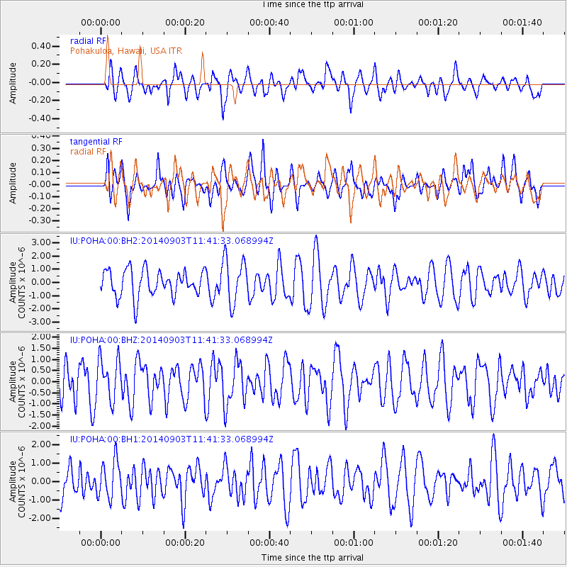
POHA Pohakuloa, Hawaii, USA - Earthquake Result Viewer
*The percent match for this event was below the threshold and hence no stack was calculated.
| Earthquake location: |
Samoa Islands |
| Earthquake latitude/longitude: |
-14.9/-172.9 |
| Earthquake time(UTC): |
2014/09/03 (246) 11:34:40 GMT |
| Earthquake Depth: |
10 km |
| Earthquake Magnitude: |
5.7 MWW, 5.7 MWC, 5.7 MWB |
| Earthquake Catalog/Contributor: |
NEIC PDE/NEIC COMCAT |
|
| Network: |
IU Global Seismograph Network (GSN - IRIS/USGS) |
| Station: |
POHA Pohakuloa, Hawaii, USA |
| Lat/Lon: |
19.76 N/155.53 W |
| Elevation: |
1990 m |
|
| Distance: |
38.5 deg |
| Az: |
26.877 deg |
| Baz: |
207.646 deg |
| Ray Param: |
$rayparam |
*The percent match for this event was below the threshold and hence was not used in the summary stack. |
|
| Radial Match: |
40.902702 % |
| Radial Bump: |
400 |
| Transverse Match: |
43.76123 % |
| Transverse Bump: |
400 |
| SOD ConfigId: |
3390531 |
| Insert Time: |
2019-04-13 19:42:09.843 +0000 |
| GWidth: |
2.5 |
| Max Bumps: |
400 |
| Tol: |
0.001 |
|
Signal To Noise
| Channel | StoN | STA | LTA |
| IU:POHA:00:BHZ:20140903T11:41:33.068994Z | 1.3795776 | 9.507448E-7 | 6.891564E-7 |
| IU:POHA:00:BH1:20140903T11:41:33.068994Z | 0.9775345 | 1.0357529E-6 | 1.0595563E-6 |
| IU:POHA:00:BH2:20140903T11:41:33.068994Z | 1.5861648 | 1.5773142E-6 | 9.9442E-7 |
| Arrivals |
| Ps | |
| PpPs | |
| PsPs/PpSs | |


