You are here: Home > Network List > US - United States National Seismic Network Stations List
> Station EGMT Eagleton, Montana, USA > Earthquake Result Viewer
EGMT Eagleton, Montana, USA - Earthquake Result Viewer
*The percent match for this event was below the threshold and hence no stack was calculated.
| Earthquake location: |
Near Coast Of Nicaragua |
| Earthquake latitude/longitude: |
12.1/-87.5 |
| Earthquake time(UTC): |
2011/05/02 (122) 23:55:39 GMT |
| Earthquake Depth: |
28 km |
| Earthquake Magnitude: |
5.5 MW, 5.6 MB |
| Earthquake Catalog/Contributor: |
NEIC PDE/NEIC PDE-M |
|
| Network: |
US United States National Seismic Network |
| Station: |
EGMT Eagleton, Montana, USA |
| Lat/Lon: |
48.02 N/109.75 W |
| Elevation: |
1055 m |
|
| Distance: |
40.3 deg |
| Az: |
336.843 deg |
| Baz: |
145.048 deg |
| Ray Param: |
$rayparam |
*The percent match for this event was below the threshold and hence was not used in the summary stack. |
|
| Radial Match: |
55.71639 % |
| Radial Bump: |
400 |
| Transverse Match: |
54.23198 % |
| Transverse Bump: |
400 |
| SOD ConfigId: |
558545 |
| Insert Time: |
2013-09-18 17:14:48.833 +0000 |
| GWidth: |
2.5 |
| Max Bumps: |
400 |
| Tol: |
0.001 |
|
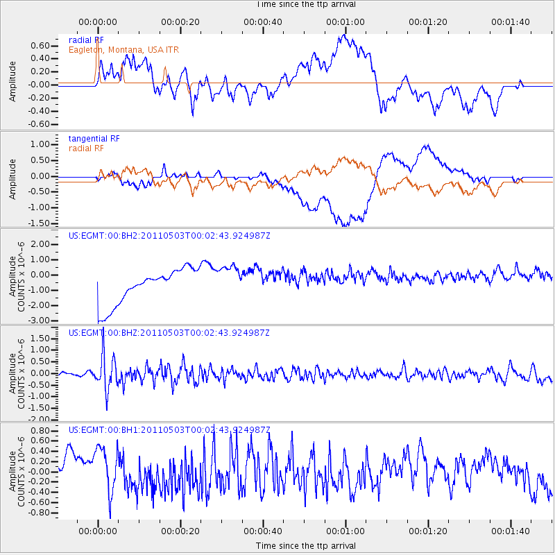
Signal To Noise
| Channel | StoN | STA | LTA |
| US:EGMT:00:BHZ:20110503T00:02:43.924987Z | 12.482692 | 7.2431243E-7 | 5.802534E-8 |
| US:EGMT:00:BH1:20110503T00:02:43.924987Z | 1.4685233 | 4.6427004E-7 | 3.1614758E-7 |
| US:EGMT:00:BH2:20110503T00:02:43.924987Z | 0.99969983 | 1.1439334E-6 | 1.1442769E-6 |
| Arrivals |
| Ps | |
| PpPs | |
| PsPs/PpSs | |


