You are here: Home > Network List > US - United States National Seismic Network Stations List
> Station ERPA Erie, Pennsylvania, USA > Earthquake Result Viewer
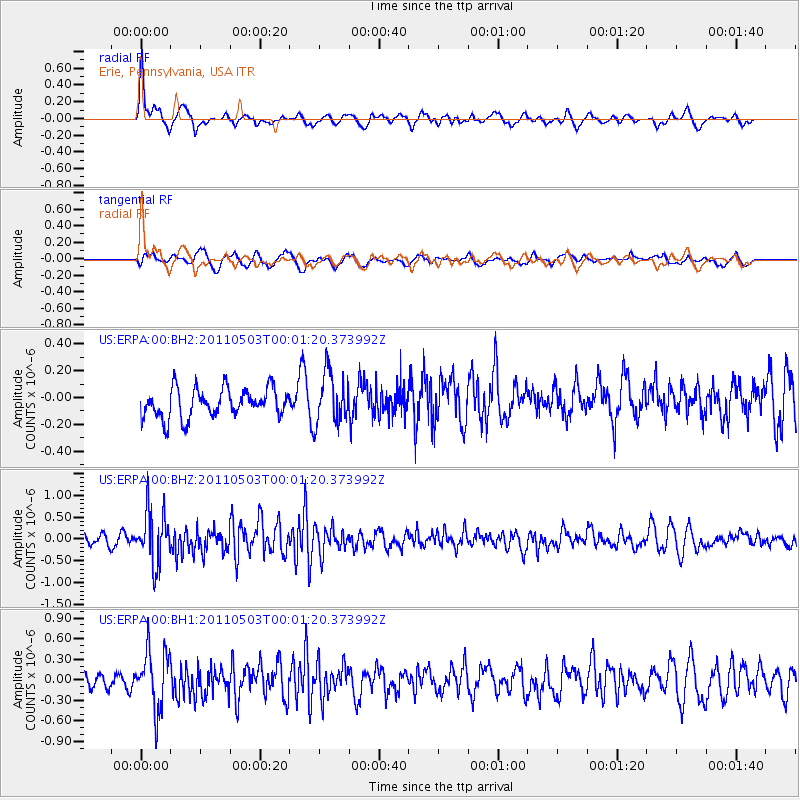
ERPA Erie, Pennsylvania, USA - Earthquake Result Viewer
*The percent match for this event was below the threshold and hence no stack was calculated.
| Earthquake location: |
Near Coast Of Nicaragua |
| Earthquake latitude/longitude: |
12.1/-87.5 |
| Earthquake time(UTC): |
2011/05/02 (122) 23:55:39 GMT |
| Earthquake Depth: |
28 km |
| Earthquake Magnitude: |
5.5 MW, 5.6 MB |
| Earthquake Catalog/Contributor: |
NEIC PDE/NEIC PDE-M |
|
| Network: |
US United States National Seismic Network |
| Station: |
ERPA Erie, Pennsylvania, USA |
| Lat/Lon: |
42.12 N/79.99 W |
| Elevation: |
306 m |
|
| Distance: |
30.6 deg |
| Az: |
10.976 deg |
| Baz: |
194.494 deg |
| Ray Param: |
$rayparam |
*The percent match for this event was below the threshold and hence was not used in the summary stack. |
|
| Radial Match: |
75.225555 % |
| Radial Bump: |
400 |
| Transverse Match: |
57.38498 % |
| Transverse Bump: |
400 |
| SOD ConfigId: |
558545 |
| Insert Time: |
2013-09-18 17:14:49.313 +0000 |
| GWidth: |
2.5 |
| Max Bumps: |
400 |
| Tol: |
0.001 |
|
Signal To Noise
| Channel | StoN | STA | LTA |
| US:ERPA:00:BHZ:20110503T00:01:20.373992Z | 4.956106 | 6.068066E-7 | 1.2243616E-7 |
| US:ERPA:00:BH1:20110503T00:01:20.373992Z | 3.530452 | 4.313344E-7 | 1.221754E-7 |
| US:ERPA:00:BH2:20110503T00:01:20.373992Z | 1.7877542 | 1.9178067E-7 | 1.0727464E-7 |
| Arrivals |
| Ps | |
| PpPs | |
| PsPs/PpSs | |


