You are here: Home > Network List > US - United States National Seismic Network Stations List
> Station HLID Hailey, Idaho, USA > Earthquake Result Viewer
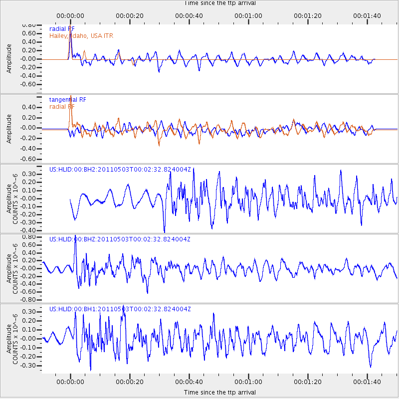
HLID Hailey, Idaho, USA - Earthquake Result Viewer
*The percent match for this event was below the threshold and hence no stack was calculated.
| Earthquake location: |
Near Coast Of Nicaragua |
| Earthquake latitude/longitude: |
12.1/-87.5 |
| Earthquake time(UTC): |
2011/05/02 (122) 23:55:39 GMT |
| Earthquake Depth: |
28 km |
| Earthquake Magnitude: |
5.5 MW, 5.6 MB |
| Earthquake Catalog/Contributor: |
NEIC PDE/NEIC PDE-M |
|
| Network: |
US United States National Seismic Network |
| Station: |
HLID Hailey, Idaho, USA |
| Lat/Lon: |
43.56 N/114.41 W |
| Elevation: |
1772 m |
|
| Distance: |
39.0 deg |
| Az: |
328.442 deg |
| Baz: |
135.244 deg |
| Ray Param: |
$rayparam |
*The percent match for this event was below the threshold and hence was not used in the summary stack. |
|
| Radial Match: |
68.11761 % |
| Radial Bump: |
400 |
| Transverse Match: |
54.782787 % |
| Transverse Bump: |
400 |
| SOD ConfigId: |
558545 |
| Insert Time: |
2013-09-18 17:14:58.049 +0000 |
| GWidth: |
2.5 |
| Max Bumps: |
400 |
| Tol: |
0.001 |
|
Signal To Noise
| Channel | StoN | STA | LTA |
| US:HLID:00:BHZ:20110503T00:02:32.824004Z | 3.433 | 3.090229E-7 | 9.001541E-8 |
| US:HLID:00:BH1:20110503T00:02:32.824004Z | 2.371469 | 1.6286405E-7 | 6.867644E-8 |
| US:HLID:00:BH2:20110503T00:02:32.824004Z | 2.0018642 | 1.7500085E-7 | 8.741894E-8 |
| Arrivals |
| Ps | |
| PpPs | |
| PsPs/PpSs | |


