You are here: Home > Network List > US - United States National Seismic Network Stations List
> Station MSO Missoula, Montana, USA > Earthquake Result Viewer
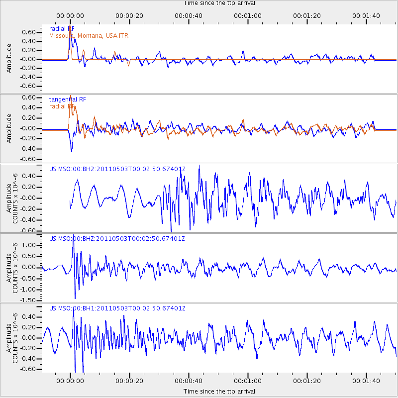
MSO Missoula, Montana, USA - Earthquake Result Viewer
*The percent match for this event was below the threshold and hence no stack was calculated.
| Earthquake location: |
Near Coast Of Nicaragua |
| Earthquake latitude/longitude: |
12.1/-87.5 |
| Earthquake time(UTC): |
2011/05/02 (122) 23:55:39 GMT |
| Earthquake Depth: |
28 km |
| Earthquake Magnitude: |
5.5 MW, 5.6 MB |
| Earthquake Catalog/Contributor: |
NEIC PDE/NEIC PDE-M |
|
| Network: |
US United States National Seismic Network |
| Station: |
MSO Missoula, Montana, USA |
| Lat/Lon: |
46.83 N/113.94 W |
| Elevation: |
1264 m |
|
| Distance: |
41.2 deg |
| Az: |
332.29 deg |
| Baz: |
138.523 deg |
| Ray Param: |
$rayparam |
*The percent match for this event was below the threshold and hence was not used in the summary stack. |
|
| Radial Match: |
69.91814 % |
| Radial Bump: |
400 |
| Transverse Match: |
49.062084 % |
| Transverse Bump: |
400 |
| SOD ConfigId: |
558545 |
| Insert Time: |
2013-09-18 17:15:12.709 +0000 |
| GWidth: |
2.5 |
| Max Bumps: |
400 |
| Tol: |
0.001 |
|
Signal To Noise
| Channel | StoN | STA | LTA |
| US:MSO:00:BHZ:20110503T00:02:50.67401Z | 7.207632 | 6.440751E-7 | 8.936016E-8 |
| US:MSO:00:BH1:20110503T00:02:50.67401Z | 1.9865966 | 2.8647955E-7 | 1.442062E-7 |
| US:MSO:00:BH2:20110503T00:02:50.67401Z | 1.4974614 | 2.2499438E-7 | 1.5025053E-7 |
| Arrivals |
| Ps | |
| PpPs | |
| PsPs/PpSs | |


