You are here: Home > Network List > II - Global Seismograph Network (GSN - IRIS/IDA) Stations List
> Station WRAB Tennant Creek, NT, Australia > Earthquake Result Viewer
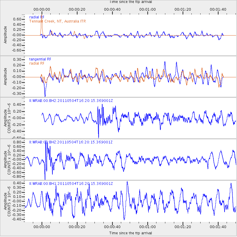
WRAB Tennant Creek, NT, Australia - Earthquake Result Viewer
*The percent match for this event was below the threshold and hence no stack was calculated.
| Earthquake location: |
Fiji Islands Region |
| Earthquake latitude/longitude: |
-20.4/-178.5 |
| Earthquake time(UTC): |
2011/05/04 (124) 16:13:28 GMT |
| Earthquake Depth: |
584 km |
| Earthquake Magnitude: |
5.6 MW, 5.2 MB, 5.6 MW |
| Earthquake Catalog/Contributor: |
WHDF/NEIC |
|
| Network: |
II Global Seismograph Network (GSN - IRIS/IDA) |
| Station: |
WRAB Tennant Creek, NT, Australia |
| Lat/Lon: |
19.93 S/134.36 E |
| Elevation: |
366 m |
|
| Distance: |
44.1 deg |
| Az: |
262.068 deg |
| Baz: |
99.055 deg |
| Ray Param: |
$rayparam |
*The percent match for this event was below the threshold and hence was not used in the summary stack. |
|
| Radial Match: |
53.374744 % |
| Radial Bump: |
400 |
| Transverse Match: |
70.98223 % |
| Transverse Bump: |
400 |
| SOD ConfigId: |
558545 |
| Insert Time: |
2013-09-18 17:16:19.132 +0000 |
| GWidth: |
2.5 |
| Max Bumps: |
400 |
| Tol: |
0.001 |
|
Signal To Noise
| Channel | StoN | STA | LTA |
| II:WRAB:00:BHZ:20110504T16:20:15.369001Z | 2.2470274 | 3.9781676E-7 | 1.7704136E-7 |
| II:WRAB:00:BH1:20110504T16:20:15.369001Z | 0.9083223 | 1.3793796E-7 | 1.5186015E-7 |
| II:WRAB:00:BH2:20110504T16:20:15.369001Z | 2.4050286 | 1.9650504E-7 | 8.170591E-8 |
| Arrivals |
| Ps | |
| PpPs | |
| PsPs/PpSs | |


