You are here: Home > Network List > US - United States National Seismic Network Stations List
> Station EGMT Eagleton, Montana, USA > Earthquake Result Viewer
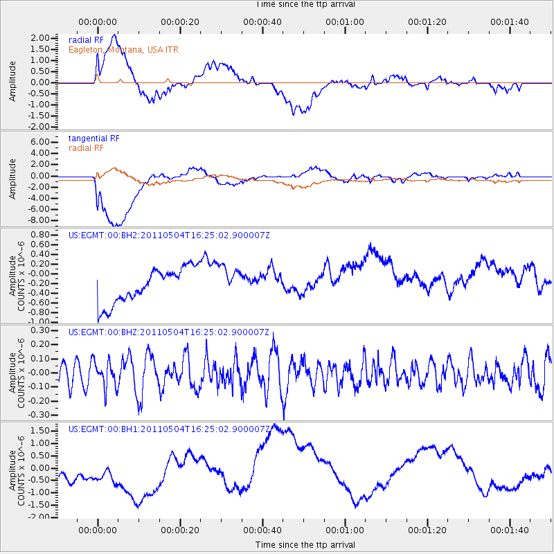
EGMT Eagleton, Montana, USA - Earthquake Result Viewer
*The percent match for this event was below the threshold and hence no stack was calculated.
| Earthquake location: |
Fiji Islands Region |
| Earthquake latitude/longitude: |
-20.4/-178.5 |
| Earthquake time(UTC): |
2011/05/04 (124) 16:13:28 GMT |
| Earthquake Depth: |
584 km |
| Earthquake Magnitude: |
5.6 MW, 5.2 MB, 5.6 MW |
| Earthquake Catalog/Contributor: |
WHDF/NEIC |
|
| Network: |
US United States National Seismic Network |
| Station: |
EGMT Eagleton, Montana, USA |
| Lat/Lon: |
48.02 N/109.75 W |
| Elevation: |
1055 m |
|
| Distance: |
91.7 deg |
| Az: |
38.763 deg |
| Baz: |
241.034 deg |
| Ray Param: |
$rayparam |
*The percent match for this event was below the threshold and hence was not used in the summary stack. |
|
| Radial Match: |
32.806812 % |
| Radial Bump: |
400 |
| Transverse Match: |
37.624817 % |
| Transverse Bump: |
400 |
| SOD ConfigId: |
558545 |
| Insert Time: |
2013-09-18 17:17:16.607 +0000 |
| GWidth: |
2.5 |
| Max Bumps: |
400 |
| Tol: |
0.001 |
|
Signal To Noise
| Channel | StoN | STA | LTA |
| US:EGMT:00:BHZ:20110504T16:25:02.900007Z | 1.0831796 | 8.9449905E-8 | 8.258086E-8 |
| US:EGMT:00:BH1:20110504T16:25:02.900007Z | 0.90164524 | 1.0198071E-6 | 1.1310514E-6 |
| US:EGMT:00:BH2:20110504T16:25:02.900007Z | 0.88964593 | 3.17438E-7 | 3.5681387E-7 |
| Arrivals |
| Ps | |
| PpPs | |
| PsPs/PpSs | |


