You are here: Home > Network List > IU - Global Seismograph Network (GSN - IRIS/USGS) Stations List
> Station HNR Honiara, Solomon Islands > Earthquake Result Viewer
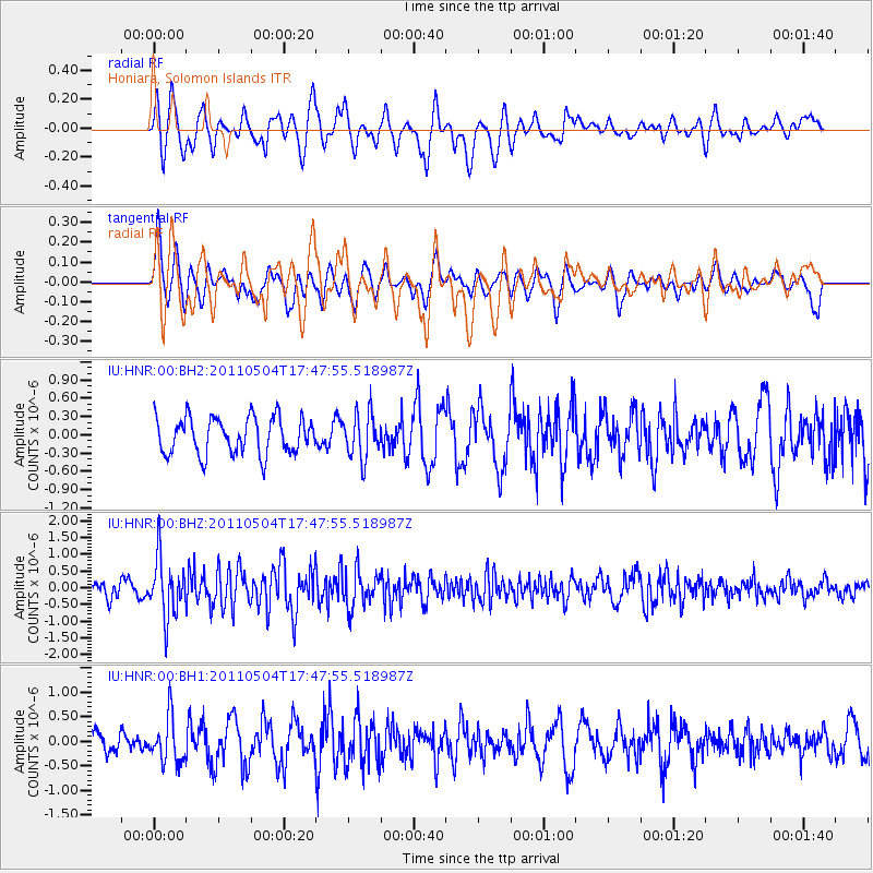
HNR Honiara, Solomon Islands - Earthquake Result Viewer
*The percent match for this event was below the threshold and hence no stack was calculated.
| Earthquake location: |
Southern Sumatra, Indonesia |
| Earthquake latitude/longitude: |
-4.9/101.8 |
| Earthquake time(UTC): |
2011/05/04 (124) 17:38:37 GMT |
| Earthquake Depth: |
26 km |
| Earthquake Magnitude: |
5.5 MW, 5.3 MS, 5.4 MB, 5.4 MW |
| Earthquake Catalog/Contributor: |
WHDF/NEIC |
|
| Network: |
IU Global Seismograph Network (GSN - IRIS/USGS) |
| Station: |
HNR Honiara, Solomon Islands |
| Lat/Lon: |
9.44 S/159.95 E |
| Elevation: |
100 m |
|
| Distance: |
57.8 deg |
| Az: |
98.03 deg |
| Baz: |
270.148 deg |
| Ray Param: |
$rayparam |
*The percent match for this event was below the threshold and hence was not used in the summary stack. |
|
| Radial Match: |
65.5521 % |
| Radial Bump: |
400 |
| Transverse Match: |
54.387386 % |
| Transverse Bump: |
400 |
| SOD ConfigId: |
558545 |
| Insert Time: |
2013-09-18 17:18:19.475 +0000 |
| GWidth: |
2.5 |
| Max Bumps: |
400 |
| Tol: |
0.001 |
|
Signal To Noise
| Channel | StoN | STA | LTA |
| IU:HNR:00:BHZ:20110504T17:47:55.518987Z | 3.2724943 | 8.6717387E-7 | 2.6498864E-7 |
| IU:HNR:00:BH1:20110504T17:47:55.518987Z | 1.9462907 | 4.630281E-7 | 2.3790285E-7 |
| IU:HNR:00:BH2:20110504T17:47:55.518987Z | 1.2415347 | 3.742361E-7 | 3.0143022E-7 |
| Arrivals |
| Ps | |
| PpPs | |
| PsPs/PpSs | |


