You are here: Home > Network List > US - United States National Seismic Network Stations List
> Station EGMT Eagleton, Montana, USA > Earthquake Result Viewer
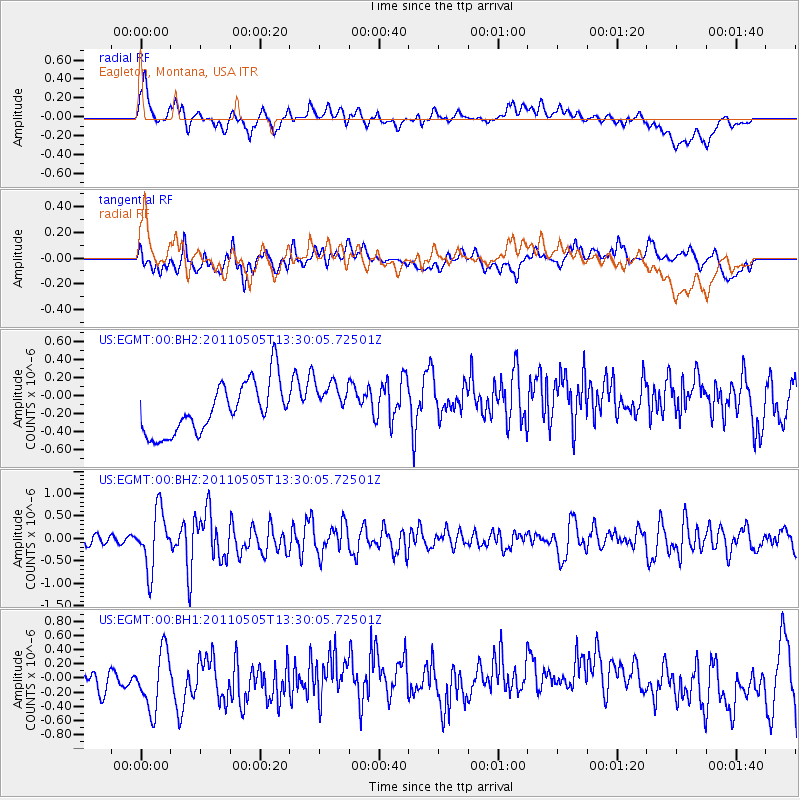
EGMT Eagleton, Montana, USA - Earthquake Result Viewer
*The percent match for this event was below the threshold and hence no stack was calculated.
| Earthquake location: |
Near Coast Of Guerrero, Mexico |
| Earthquake latitude/longitude: |
16.8/-98.6 |
| Earthquake time(UTC): |
2011/05/05 (125) 13:24:07 GMT |
| Earthquake Depth: |
24 km |
| Earthquake Magnitude: |
5.7 MW, 5.4 MS, 5.4 MB, 5.5 MW |
| Earthquake Catalog/Contributor: |
WHDF/NEIC |
|
| Network: |
US United States National Seismic Network |
| Station: |
EGMT Eagleton, Montana, USA |
| Lat/Lon: |
48.02 N/109.75 W |
| Elevation: |
1055 m |
|
| Distance: |
32.5 deg |
| Az: |
346.024 deg |
| Baz: |
159.84 deg |
| Ray Param: |
$rayparam |
*The percent match for this event was below the threshold and hence was not used in the summary stack. |
|
| Radial Match: |
61.698353 % |
| Radial Bump: |
400 |
| Transverse Match: |
55.56954 % |
| Transverse Bump: |
400 |
| SOD ConfigId: |
558545 |
| Insert Time: |
2013-09-18 17:20:32.242 +0000 |
| GWidth: |
2.5 |
| Max Bumps: |
400 |
| Tol: |
0.001 |
|
Signal To Noise
| Channel | StoN | STA | LTA |
| US:EGMT:00:BHZ:20110505T13:30:05.72501Z | 5.2655344 | 6.321263E-7 | 1.2004978E-7 |
| US:EGMT:00:BH1:20110505T13:30:05.72501Z | 2.8004537 | 4.3337877E-7 | 1.5475305E-7 |
| US:EGMT:00:BH2:20110505T13:30:05.72501Z | 0.8626808 | 2.402287E-7 | 2.7846764E-7 |
| Arrivals |
| Ps | |
| PpPs | |
| PsPs/PpSs | |


