You are here: Home > Network List > US - United States National Seismic Network Stations List
> Station HDIL Hopedale, Illinois, USA > Earthquake Result Viewer
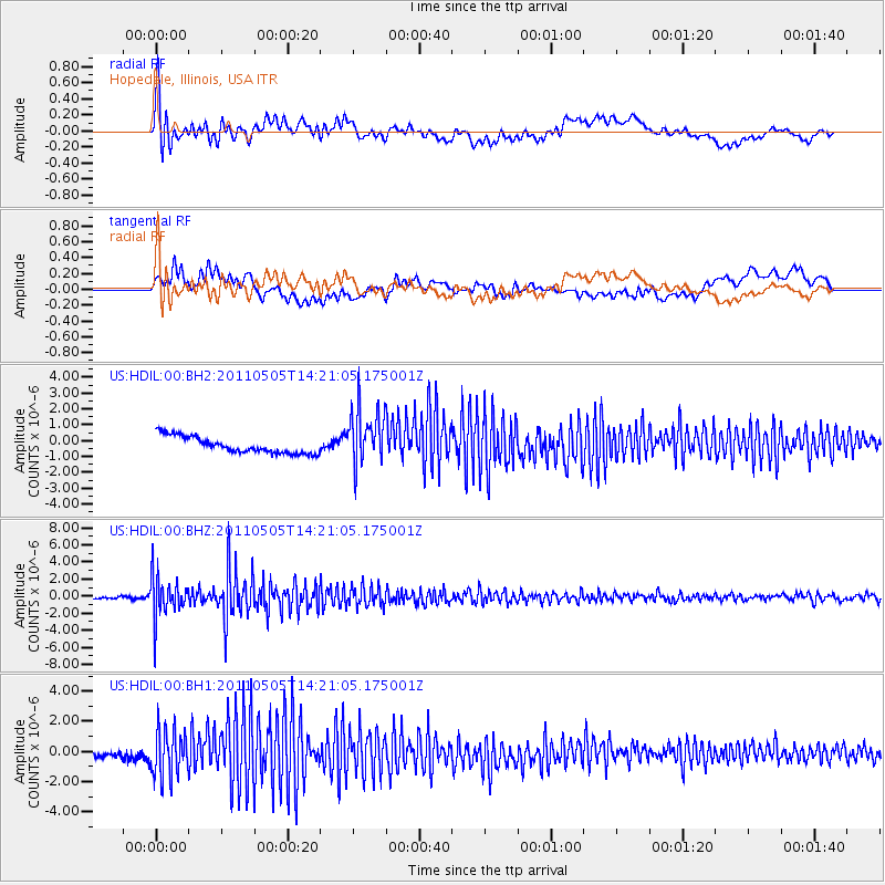
HDIL Hopedale, Illinois, USA - Earthquake Result Viewer
*The percent match for this event was below the threshold and hence no stack was calculated.
| Earthquake location: |
Alaska Peninsula |
| Earthquake latitude/longitude: |
55.1/-160.5 |
| Earthquake time(UTC): |
2011/05/05 (125) 14:13:01 GMT |
| Earthquake Depth: |
39 km |
| Earthquake Magnitude: |
5.9 MB, 5.3 MS, 5.7 MW, 5.7 MW |
| Earthquake Catalog/Contributor: |
WHDF/NEIC |
|
| Network: |
US United States National Seismic Network |
| Station: |
HDIL Hopedale, Illinois, USA |
| Lat/Lon: |
40.56 N/89.29 W |
| Elevation: |
219 m |
|
| Distance: |
47.9 deg |
| Az: |
76.604 deg |
| Baz: |
312.785 deg |
| Ray Param: |
$rayparam |
*The percent match for this event was below the threshold and hence was not used in the summary stack. |
|
| Radial Match: |
77.99125 % |
| Radial Bump: |
400 |
| Transverse Match: |
48.521515 % |
| Transverse Bump: |
400 |
| SOD ConfigId: |
558545 |
| Insert Time: |
2013-09-18 17:23:49.938 +0000 |
| GWidth: |
2.5 |
| Max Bumps: |
400 |
| Tol: |
0.001 |
|
Signal To Noise
| Channel | StoN | STA | LTA |
| US:HDIL:00:BHZ:20110505T14:21:05.175001Z | 19.116816 | 2.3641583E-6 | 1.2366904E-7 |
| US:HDIL:00:BH1:20110505T14:21:05.175001Z | 6.266825 | 1.5360401E-6 | 2.451066E-7 |
| US:HDIL:00:BH2:20110505T14:21:05.175001Z | 3.4158907 | 1.7978364E-6 | 5.2631555E-7 |
| Arrivals |
| Ps | |
| PpPs | |
| PsPs/PpSs | |


